Figures & data
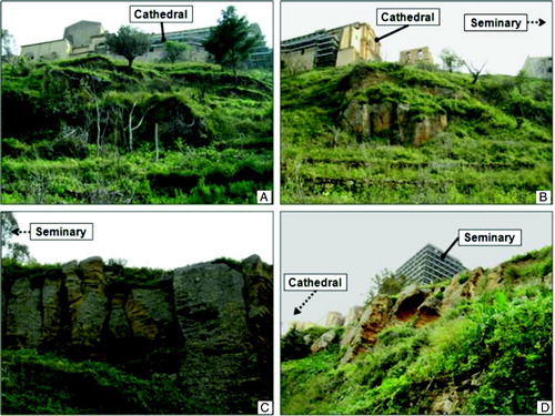
Figure 1. Location of the north-western slope of Girgenti hill in Sicily, Italy (A) and aerial views at 45° of the areas of the Bibbirrìa Sq. (B), St. Gerlando's Cathedral and the Bishop's Seminary (C), affected by widespread ground instability. Trace of the main fracture is shown in (A), while major scarps are represented in (B) and (C). Aerial views in (B) and (C) are modified from Bing Maps (© 2011 Microsoft).
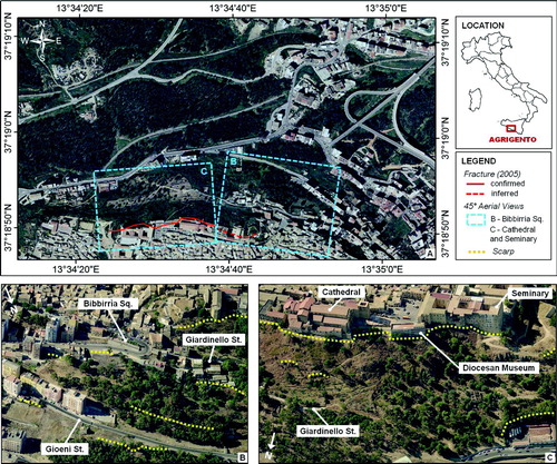
Figure 2. Geological map of the study area (Cigna et al., Citationforthcoming).
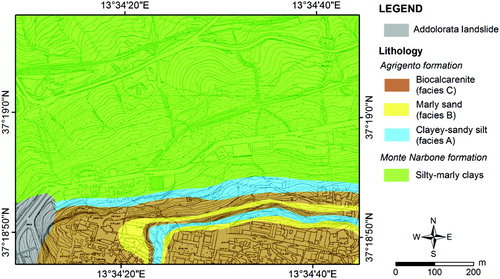
Figure 3. Flowchart of the procedure used to carry out the geomorphological mapping in Agrigento, Italy.
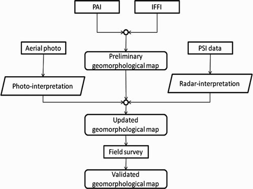
Figure 4. Pre-existing landslide mapping in the north-western sector of Agrigento. (A) PAI (Piano di Assetto Idrogeologico, Hydrogeological Setting Plan; CitationRegione Siciliana, 2006); (B) IFFI (Inventario dei Fenomeni Franosi in Italia, Landslide Inventory in Italy; ISPRA, Citation2007).
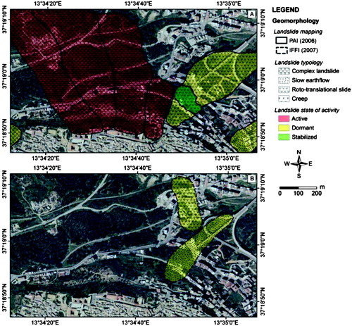
Figure 5. Coverage, tracks and frames of the eight aerial photographs at scale 1:8000 used for stereographic photo-interpretation in Agrigento.
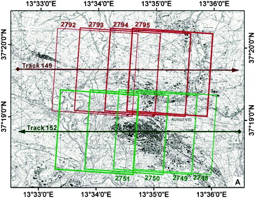
Figure 6. Example of aerial photograph covering the western portion of the urban area of Agrigento (track 152, frame 2750; ).
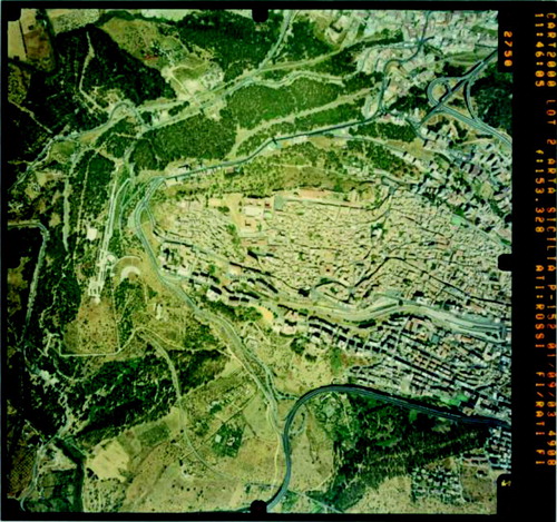
Table 1. PSI data stacks analysed for the area of Agrigento.
Figure 7. Deformation velocities in the north-western area of Agrigento, measured in 1992–2010 along the satellite LOS of ERS1/2 descending (A), ENVISAT descending (B) and ascending (C), and RADARSAT1 ascending (D). Data stack dates, processing techniques and orbits are summarized in .
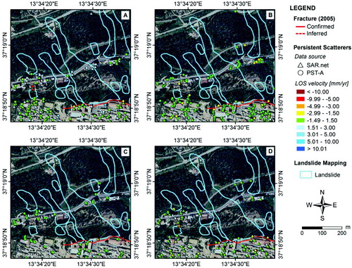
Figure 8. Photos of the north-western slope of Girgenti hill, taken during the 2007 and 2011 field surveys.