Figures & data
Figure 1. (A) MOLA-derived topographic map of Mars showing the location of the Elysium volcanic province (EVP); (B) MOLA-derived shaded relief map of EVP and the location of Hecates Tholus shield volcano; and (C) Mosaic of THEMIS-IR daytime images of Hecates Tholus volcano and the location of the mapped area (shown in ).
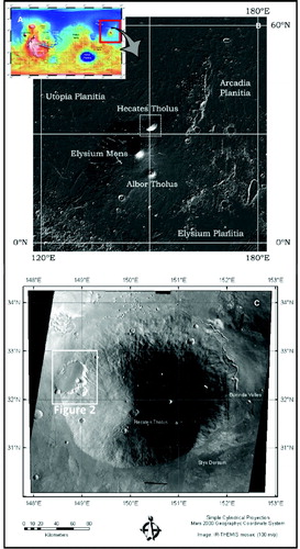
Figure 2. Composition of CTX images of the study area used here to develop the geomorphological cartography (images source: CTX/MRO/MSSS/NASA).
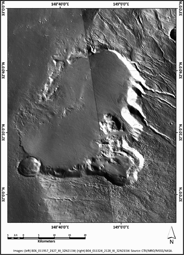
Table 1. Mapped geomorphological units and elements, and their interpreted origin.
Supplemental material