Figures & data
Figure 1. Geological sketch map of southern Apennines. The red frame indicates the study area (modified after Piedilato and Prosser [Citation2005]).
![Figure 1. Geological sketch map of southern Apennines. The red frame indicates the study area (modified after Piedilato and Prosser [Citation2005]).](/cms/asset/407df5f4-0d83-4503-b177-ed432aadf2fc/tjom_a_722403_o_f0001g.jpg)
Figure 2. Panoramic view of the high Agri Valley.
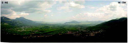
Figure 3. Stratigraphic sections from the study area.
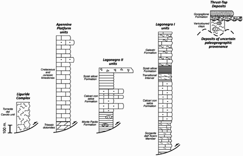
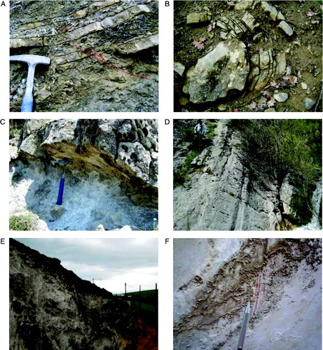
Figure 4. (A) Green and red shale and subordinated sandstones belonging to the ‘Torrente del Cavolo’ unit outcropping in the Sorgente Copone area. (B) Basal part of the ‘Apennine platform’ succession in a quarry around the town of Marsicovetere. The lower part of the quarry (light grey) is composed of Triassic dolomite; the upper part (dark grey) is made up of Jurassic limestone. Low angle (a) and high angle (b) tectonic contact separate the two lithofacies. (C) ‘Sorgente dell'Acero’ member at the base of the Mt. Corno section. (D) Typical rocks association within the distal facies (Lagonegro I) of ‘Scisti silicei’ Formation at Mt. Farneta. (E) Polygenic conglomerate belonging to coarse grained facies of the ‘Gorgoglione’ flysch, outcropping in the Serra la Mandra area. (F) Roughly stratified breccias referred to the lower and middle Pleistocene (CitationGiano et al., 2000). (Hammer is ca.30 cm long).
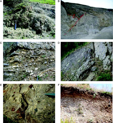
Figure 5. (A) Pre-orogenic outcrop-scale normal fault within the ‘Sorgente dell'Acero’ member. (B) Meso-scale fold within bedded micritic limestone belonging to the ‘Sorgente dell'Acero’ member. (C) Low angle normal fault within Campanian-Lucanian limestone in a quarry near Serritello locality. (D) Moderately dipping normal fault bounding the western flank of the Sorgente Copone graben. (E) Recent normal fault cutting the Eastern flank of the high Agri Valley. (F) Slickenside striations on a recent normal fault plane bounding the high Agri Valley. (Hammer is ca.30 cm long; Pen is ca.10 cm long).