Figures & data
Figure 1. Location of Jefferson County Public Schools (JCPS) and the Louisville metropolitan area, USA. The choropleth map presents percent of black students across 22 school districts and the column chart illustrates the contrast between JCPS and its vicinity in racial composition.
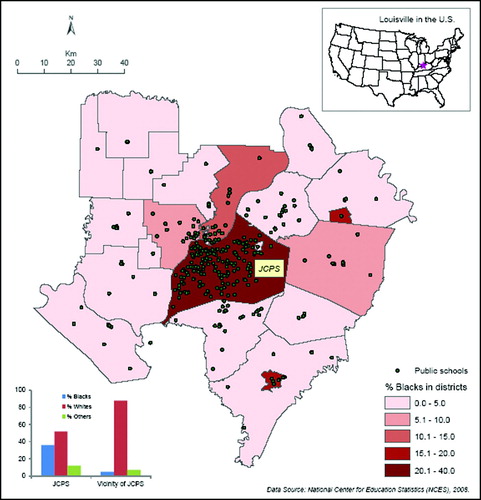
Table 1. Student enrollment (1987–2008, breakdown by race) in each school district in the Louisville metropolitan area, KY-IN, USA.
Table 2. Results of segregation measures: Dissimilarity index vs. S index for JCPS and the affiliated Louisville metropolitan area for selected years.
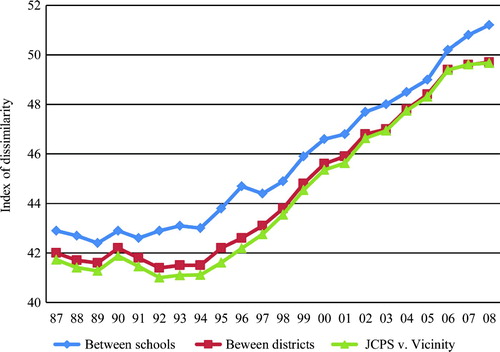
Figure 2. Index of dissimilarity values (1987–2008) calculated for the Louisville metropolitan area using student enrollment (k-12) aggregated to three spatial levels: schools, school districts, and JCPS and its vicinity.
Supplemental material