Figures & data
Figure 1. Map of the 1724 Enumeration Areas with the neighborhood boundaries and the number respondent locations from the Women's Health Survey of Accra II for each of the neighborhoods within the Accra Metropolitan Area.
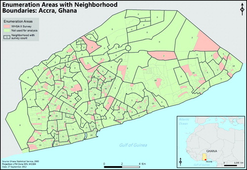
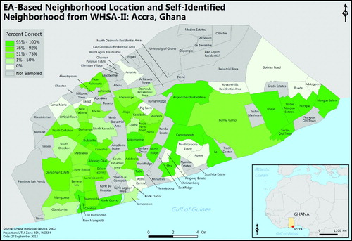
Figure 2. Map of Enumeration Area-based location and percent correct of self-identified neighborhood from the Women's Health Survey of Accra II data. Data were stratified using natural breaks.
Supplemental material