Figures & data
Table 1. Lithological classes used to define the national lithological map.
Table 2. Geomorphological classes used to define the national geomorphological map.
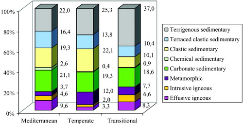
Figure 1. Percentage of area covered by the Land Systems in Italy, arranged according to the reference Land Regions.
Supplemental material