Figures & data
Figure 1. Hydrogeological background of the study areas: Alardo and Touca sites (adapted from CitationCarvalho, 2006; CitationCarvalho, Espinha Marques, Afonso, & Chaminé, 2007).
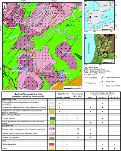
Figure 2. Regional framework of the study area (Alardo and Touca sites): (A) Morphotectonic general features from Northern Portugal (adapted from CitationBrum Ferreira, 1991); (B) Satellite image (compiled from Landsat 7 ETM + data, 2000/01; all IR colour, bands 7-4-5 = RGB; adapted from Global Land Cover Facility) and main hydromineral springs (adapted from CitationCarvalho et al., 2007); (C) Shaded relief and regional hydrogeology (adapted from CitationCarvalho et al., 2007); (D) Slope of the region.
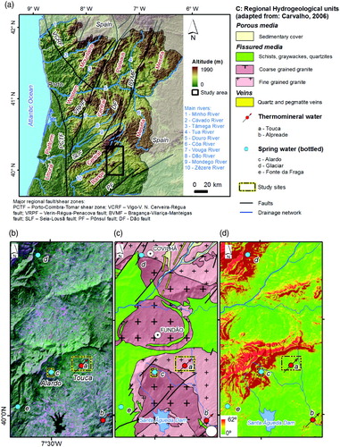
Figure 3. Field aspects of the studied sites: (a) View of Alardo site and ‘Cova da Beira’ plains in the background; (b) General view of Gardunha mountain ridge; (c) Hydrogeological inventory mapping: water mine excavated in granite; (d) Granitic core stones and weathered granite in Gardunha sloped area; (e) View of Touca plains, with Gardunha mountain system in the background; (f/g) Outcrop and weathered granite in Touca site.
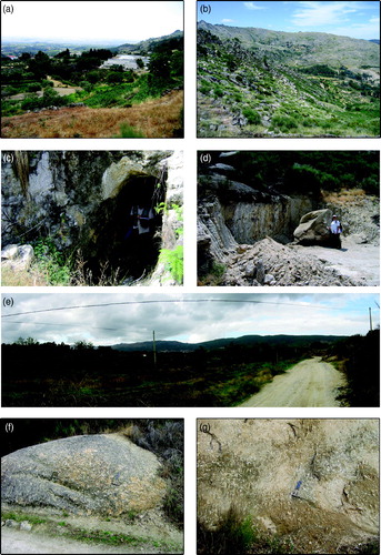
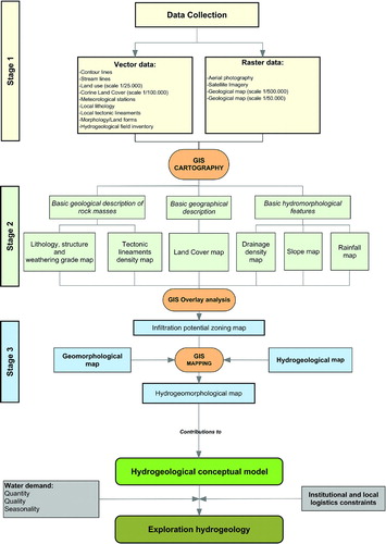
Figure 4. Conceptual flowchart of the hydrogeomorphological mapping methodology applied to the Alardo and Touca sites (Portugal).