Figures & data
Figure 1. Overview of the mountainous regions of central Asia with the black box showing the map that covers the Tian Shan study area (638,000 km2).
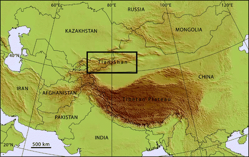
Figure 2. Map of the study area, with elevation, country borders, and major cities. A–E denote the location of landform examples shown in .
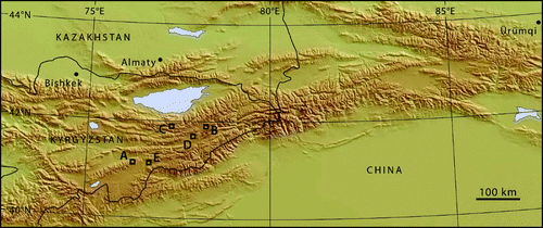
Table 1. Landsat 7 ETM+ imagery used in this study to map the glacial geomorphology of the Tian Shan. All images were downloaded from GLCF (Citation2009).
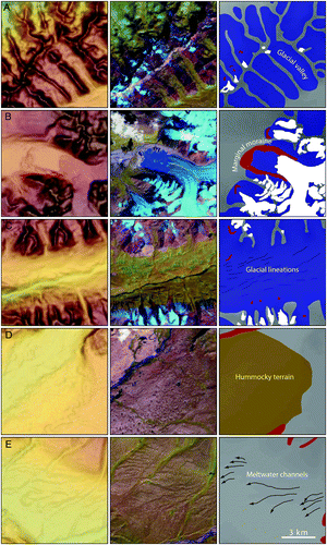
Figure 3. Landform examples with SRTM DEM panels (left), Landsat 7 ETM+ satellite imagery (middle), and mapped landforms (right). The DEM panels (left) are draped with a semi-transparent slope model in image A, and by a semi-transparent hillshade model in images B–E. The Landsat images (middle) are composites of bands 5, 4, 2, and are draped by a semi-transparent panchromatic image of band 8. North is towards the top of the panels and each panel is 9 × 9 km, see scale bar in panel E (right). (A) Glacial valleys oriented in a NW–SE direction. Note that contemporary glaciers are shown in light blue in the middle panel. (B) Marginal moraine deposited along the edge of a valley glacier. Note the lake dammed by the moraine in the middle panel. (C) Glacial lineations in a glacial valley. (D) Hummocky terrain. (E) Meltwater channels.