Figures & data
Figure 1. Geological sketch map of the north-eastern portion of the Southern Apennines with the location of the study area (modified after Vezzani et al., 2004).
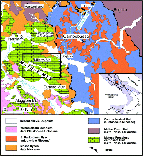
Figure 2. Panoramic views of the major cirque of Mt. Miletto, named Circo Maggiore, (A) and of the arête that separates the two glacial troughs departing from the eastern cirques of Colle Tamburo (B); the moraine deposits outcropping immediately north to the Campitello Plain (C) and near the Stazione Teleferica (D) at ∼1400 and 800 m a.s.l., respectively, made of prevailing sub-angular, centimetric to metric calcareous clasts in abundant sandy-silty matrix.
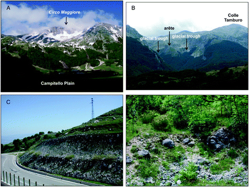
Figure 3. View of the open karst depression located west to the Campo Puzzo polje (the dashed black arrows indicate the direction of surface drainage); in the background, the dolines present on the surfaces of fluviokarst origin of Serra le Tre Finestre (A); panoramic view of the Matese Lake polje (B) and of the Campitello Plain polje in June 2012 (C) and May 2009 (D).
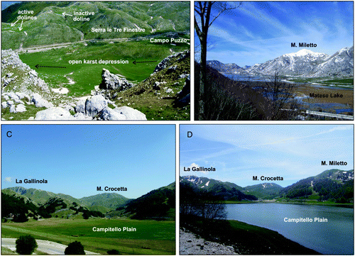
Figure 4. The major alluvial fan present within the Matese Lake polje (A); the southern slope of Serra delle Vallocchie Scure, intensively dissected by gullies (B).
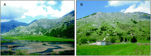
Figure 5. View of the residual fault scarps of Mt. Crocetta and La Gallinola, bordering the Matese Lake polje to the north. This is shown by the edges of some of the suspended valleys of fluviokarst orgin (fk valley) and some gully incisions.
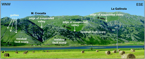
Figure 6. The northern slope of La Gallinola with its free face and active talus slopes and scree fans (A); the southern slope of La Gallinola with largely vegetated and stabilized talus slopes and scree fans (B); the lithified talus slope outcropping at Serra delle Macchietelle, characterized by steeply inclined strata, clearly discontinuous to the actual slope (C), made of alternating layers of sands and carbonate clasts in sandy-silty matrix (D).
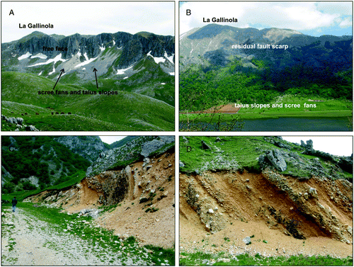
Figure 7. Panoramic view of the residual fault scarp of Mt. Soglio bordering southwards the Matese Lake polje.
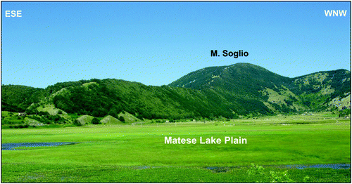
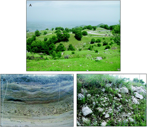
Figure 8. View of the hummocky-like surface of fluviokarst origin of Pianelle, located north to Serra le Tre Finestre (A); detailed views of the laminated fluvio-lacustrine deposits of Serra San Giorgio, made of silts and clays with interbedded reworked volcaniclastic material and rounded pebbles (B) and of the glacial deposits above (C), made of angular and subangular heterometric, calcareous clasts with sandy-silty matrix.