
Figures & data
Figure 1. Location of the Rotolon landslide within the Upper Agno Valley. The three villages threatened by the 2010 debris flow are shown.
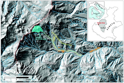
Figure 2. (A) The Rotolon creek valley and main structural lineaments controlling the geometry of the Rotolon landslide in its different sectors. (B) Plot diagram showing the horizontal attitude of bedding (central pole) and the geometry of two joints systems (J1 and J2), NNE-SSW and E-W oriented respectively. Data were collected along the ridge above the landslide crown.
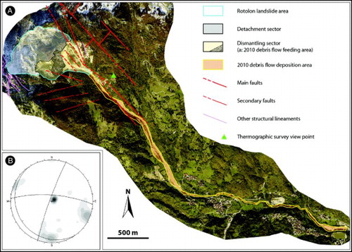
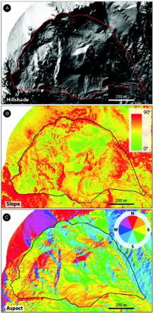
Figure 3. Thematic maps obtained by DTM analysis. (A) Hillshade; (B) Slope; (C) Aspect.
Supplemental material