Figures & data
Figure 1. The Teleccio Glacier under the pyramidal peak of Torre del Gran San Pietro (3692 m), viewed looking North-East from the peak of Gran Carro (2961 m), in a drawing of 1850 by M. A. Relly (left) and in a 2003 photo by D. Cat Berro (right).
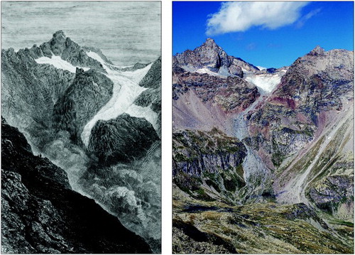
Table 1. Morphometric parameters of the LIA and 2006 glaciers. n.°: LIA and 2006 glacier codes. Hmax: highest altitude. Hmin: lowest altitude. S: surface. N.o: CGI and WGI codes.
Figure 2. The Levanna Orientale Glaciers viewed looking West from Barrouard (2856 m). The upper photo was taken in 1902 by C. Grosso, the lower photo by F. Rogliardo in 2011 (source: CGI archives).
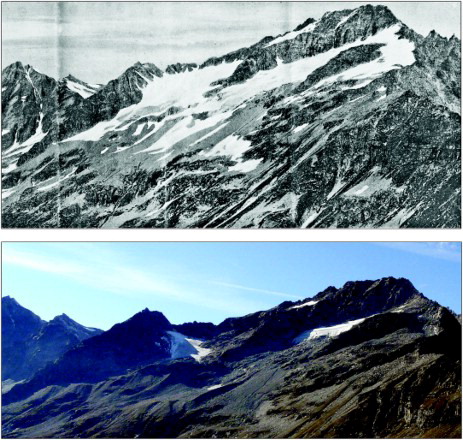
Figure 3. The Capra Glacier viewed looking South-West from the Lago Serrù dam (2283 m). Left in a 1957 photo from CGI archives, right in a 2010 photo by G. Fioraso.
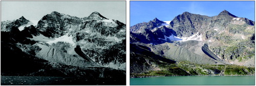
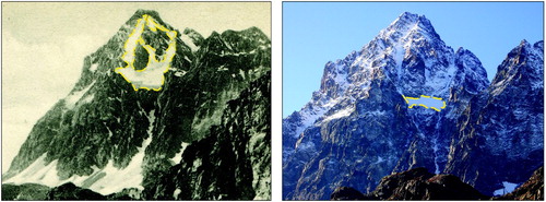
Figure 4. Comparison of the Coolidge Superiore Glacier extent (yellow dashed line) between around 1925 (left, CGI archives) and 2012 (right, photo by G. Fioraso), viewed looking SSE from Pian del Re (2013 m).