Figures & data
Figure 1. Methodological framework for mapping procedure.
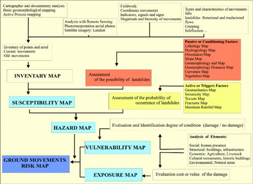
Figure 2. Weighting Conditioning Factors.
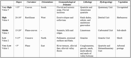
Figure 3. Validate process of mapping the ground Movements risk, overlaying different types of ground Movements on susceptibility map (left) and ground Movements risk map (right).
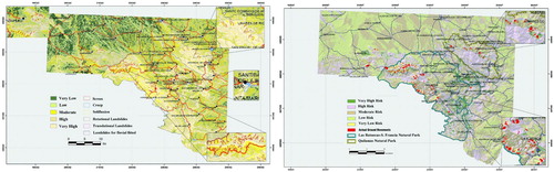
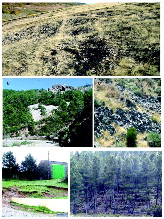
Figure 4. A. Slope instability by lateral fluvial erosion and waterlogging favoured by detrital material. Alba de Yeltes. B. Rotational landslide caused by unstable river margin. Aldehuela of Yeltes. C. Flows of rock fragments-scree-vegetation with scattered vegetation nuclei. Serradilla del Arroyo. D. sliding caused by fractures crossing in Armorican quartzite. Monsagro. E Scars of shallow landslides associated with fluvial incision into an old fracture. La Bastida. F. Break in slope rollover Armorican quartzite. Pastores. G. Destabilisation of the retaining wall of a crag. Monsagro. H. Intense erosion promoted by a road cut.
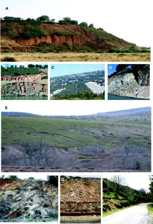
Figure 5. A. Soil processes striated by reptation for frost wedging. La Bastida. B. Retaining walls that impede progress with stone flows on the valley road from Las Batuecas. C. Avalanches of rock fragments by solifluction processes. Pico Cervero. D. Shallow landslides in clay materials as a result of high rainfall. La Atalaya. E. Reforestation and stepped terraces as a corrective measure to prevent soil creep processes in areas of average slopes. Serradilla del Arroyo.