
Figures & data
Table 1. Data information table.
Figure 1. Shifting position of GCPs in NDVI and image classification.
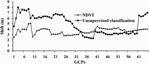
Figure 2. Shift in the position of actual and predicted shoreline.
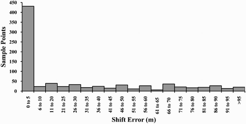
Figure 3. Distribution of area in grids for different years.
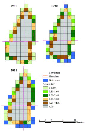
Table 2. Erosion, accretion, net areal changes and statistics of shoreline change of Sagar Island in EPR model.
Figure 4. Predicted area for 2021 and 2031.
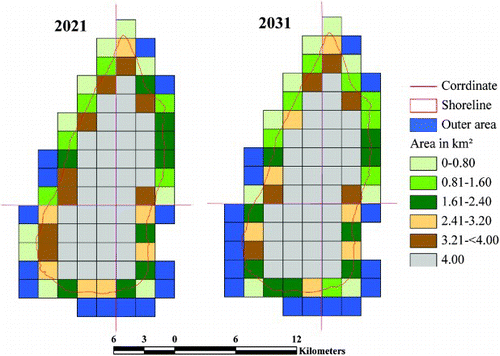
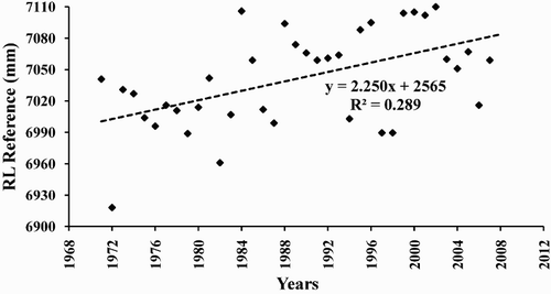
Figure 5. Annual sea level change.
Supplemental material