
Figures & data
Figure 1. Schematic lithostratigraphic map of the Veneto Region.
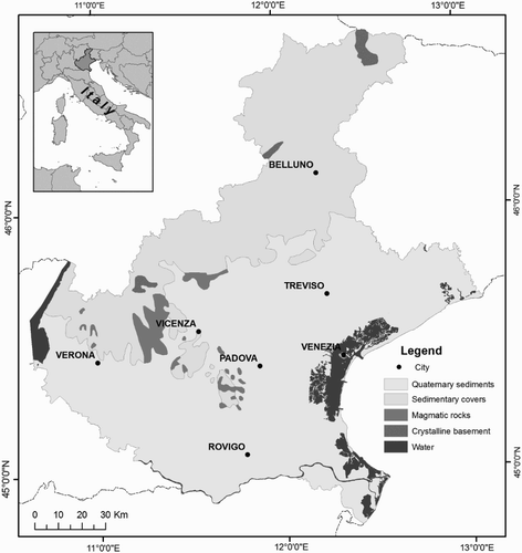
Figure 2. The locations of the collected rock samples and the effective flight lines: the maximum line spacing is approximately 2.5 km.
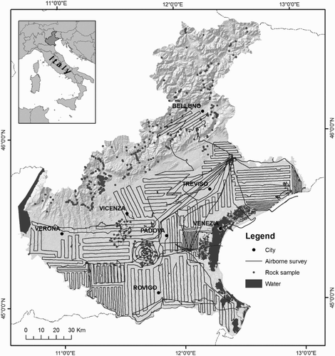
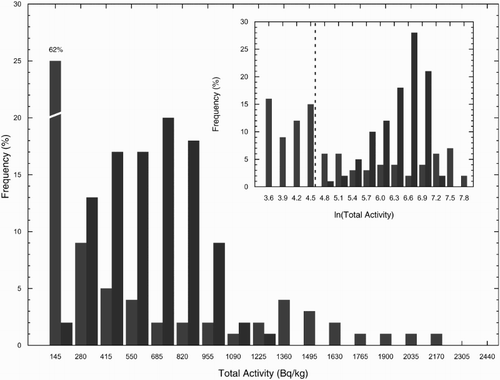
Figure 3. The frequency distributions of the total activity concentration in rock samples (blue) and airborne γ-ray data measurements (red). The samples on the left of the dashed line are characterized by at least one concentration of K, U and Th below the MDA.
Supplemental material