Figures & data
Figure 1. Shaded relief map of Lipari edifice (isobaths every 100 m). Dashed polygons point out the sectors where cumulative slope gradients were computed. BV: Bocche di Vulcano, LSB: Lipari-Salina Basin; LIP: Lipari village; MR: Monterosa, FV: Forgia Vecchia, PC: Punta della Castagna.
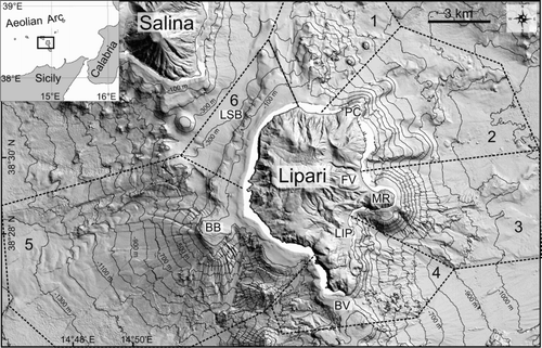
Figure 2. Cumulative slope gradients according to CitationMitchell et al. (2002). Slope gradients within each area (see for division) were sorted according to depth intervals of 25 m, and a slope cumulative distribution was calculated for each depth interval. Continuous line indicates 50% percentile (median) of the distribution, while dash line is used for 25% and 75% of the distribution.
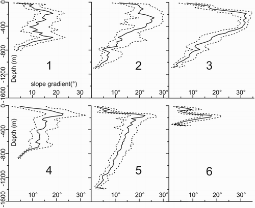
Figure 3. Morphological map of Lipari offshore, showing the main volcanic and erosive-depositional features.
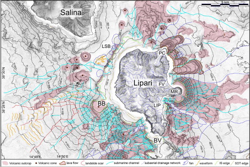
Figure 4. 3-D view (vertical exaggeration 1,5×) of the northern (a), south-western (b), and south-eastern flank (c) of Lipari, where the main volcanic and erosive-depositional features are recognizable. Dashed black line indicates the coastline. IS: insular shelf, BB: Banco del Bagno, MR: Monterosa, LSB: Lipari-Salina Basin, BV: Bocche di Vulcano. Shallow-water gaps on multibeam were filled up to improve readability of the images.
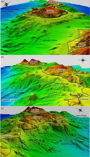
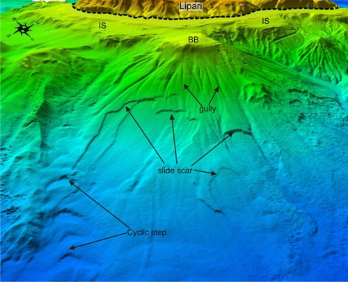
Figure 5. 3-D view of the Banco del Bagno volcanic cone in the western part of Lipari, where nested slide scars, gullies and waveforms (cyclic steps) are present. Dashed black line indicates the coastline BB: Banco del Bagno, IS: insular shelf.