
Figures & data
Figure 1. Location map of the study area.
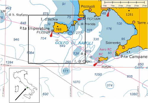
Table 1. Multibeam equipment used.
Figure 2. DTM of Ischia Island. (a) Shaded relief; (b) Aspect map; (c) Slope map.
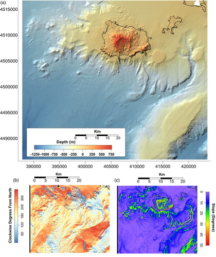
Figure 3. Diagram showing the main morphological units of the seafloor surrounding Ischia.
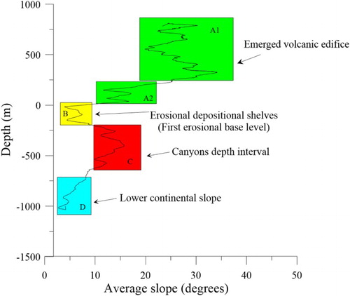
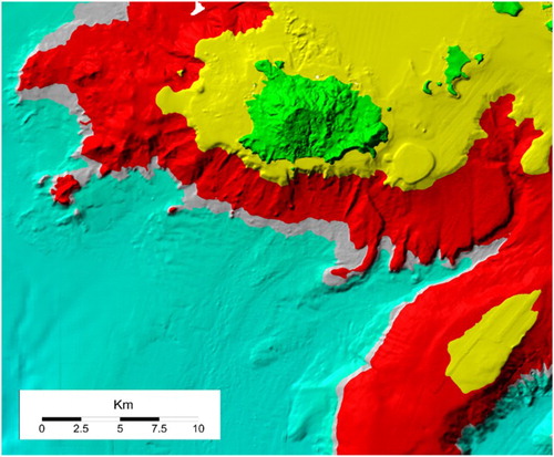
Figure 4. DTM of Ischia Island. Colours represent the main morphological units based on slope/depth pairs. See text for further details.
Supplemental material