Figures & data
Figure 1. Geographical position and main features of EA4B. The figure shows the extent of EA4B during the initial phases of petroleum exploration by Dominion Uganda Ltd., between 2007 and 2010. Also shown are the two volcanic provinces in the basin, the location of dated Dura limestones, and the position of the Kazinga–Kikarara–Kiruruma Fault Zone and Bwambara trough.
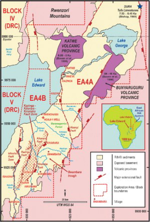
Figure 2. Lithostratigraphic schemes produced in studies of the Lake Edward–Lake George basin between 1960 and 2000. A variety of informal formations were recognised at individual exposures across the area, ranging in age from Late Miocene to Holocene.
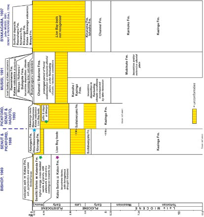
Figure 3. Stratigraphic summary chart of shallow cored sediments in eastern Lake Edward based on IDEAL studies, correlated against age dates from Katwe and Bunyaruguru tuffs and previous age attempts on sporadic occurrences of hot spring tufa limestones within the basin. Coloured stars indicate where units identified in would plot in this stratigraphic scheme. Although the Lake Edward cored sediments are likely to be younger than most onshore exposures, the Kikyere swamp clays may correspond to one or more of the wet phases indicated during the Holocene.
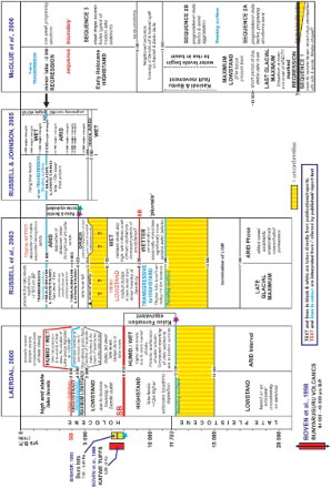
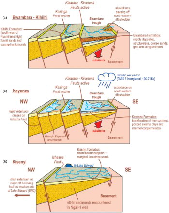
Figure 4. Block cartoon to illustrate the main phases of extension and subsidence which developed the Bwambara trough and its associated sedimentary rift-fill. The cartoon broadly corresponds to the line of section L8, NW–SE across the onshore part of the basin, and also incorporates features from further to the south-west. As such, the cartoon is not drawn to any scale and should be considered schematic only.