
Figures & data
Figure 1. Architectural typology of buildings.
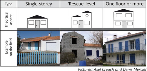
Figure 2. Matrix used for the map.
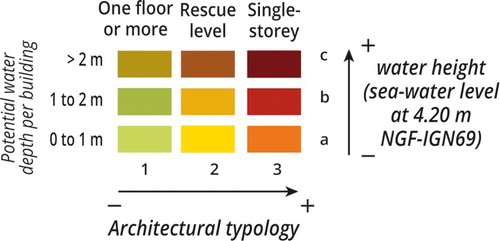
Figure 3. Distribution of buildings per municipality.
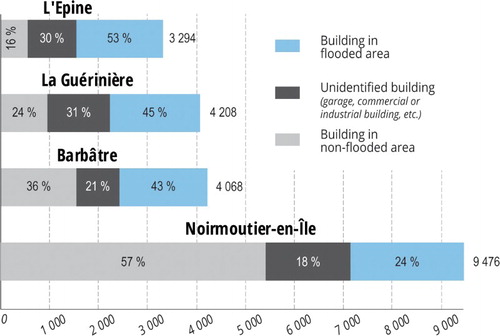
Figure 4. Proportion of vulnerable buildings per municipality.
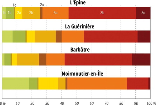
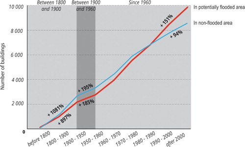
Figure 5. Evolution of buildings on Noirmoutier Island.
Supplemental material