
Figures & data
Figure 1. Distribution of the main morphometric parameters in the analyzed basin/fan systems.
Figure 2. Evidence of historical flood events in the study areas. (a) and (b) Sala Consilina town (1927) (Maddalena Mts); (c) and (d) Piedimonte Matese town in 1966 (MateseMts); (e) Alife town in 1948 (MateseMts) and (f) Raviscanina town in 2002 (MateseMts). (Modified by CitationCaiazza, 2002).
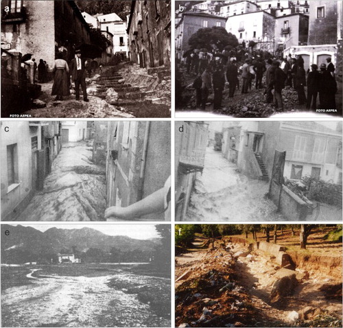
Table 1. Historical data set of past floods.
Figure 3. Flow chart of the applied methods.
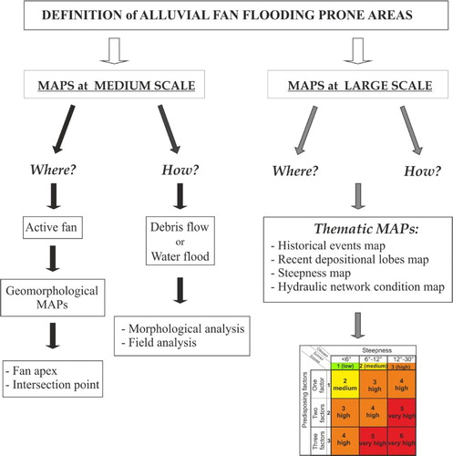
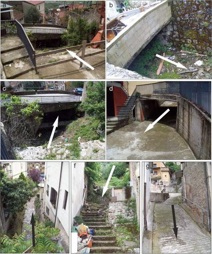
Figure 4. Examples of hydraulic critical points in Sala Consilina: (a), (b) (c) and (g) the main stream is channeled underground; (d) and (f) the stream re-emerges, but its bed has become a road; (e) the stream has a very small cross-section and is completely surrounded by houses.
Supplemental material