Figures & data
Figure 1. The study region covers the Parlung Zangbo Valley (PV), southeastern Tibetan Plateau. The extents of other glacial geomorphological maps, including Tanggula Shan (TS) by CitationMorén et al. (2011), Bayan Har Shan (BHS) by CitationHeyman et al. (2008), and Shaluli Shan (SS) by CitationFu et al. (2012).
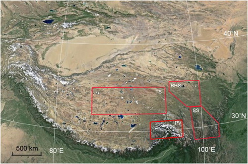
Figure 2. Google Earth imagery of the middle part of the Parlung Zangbo Valley and its tributaries (the Bodui Zangbo Valley and the Quzong Zangbo Valley). Moraines are marked as red polygons.
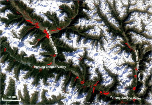
Figure 3. Layer colored map of the study area with the locations of , 5a, 5b, 6a, 6b, 7a, 7b, and 8. This shaded-relief map is created using the 30-mASTER Global Digital Elevation Model (2011) (USGS 2014). Field track indicates the route of field investigation. Blue arrows indicate the flow direction of rivers.
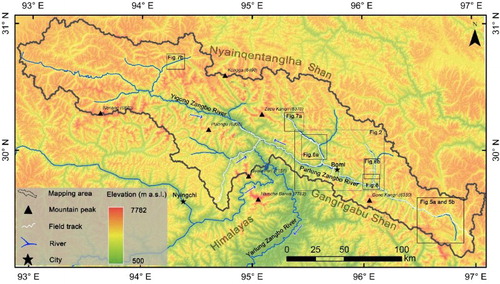
Figure 4. Field photos of glacial features. (a) Glacial valley and (c) hummocky terrains in the Bodui Zangbo Valley. (b) Glacial valley and (d) marginal moraines of the Quzong Zangbo Valley. (e) Tributary glacial valley (left) and main glacial valley (middle) of the Quzong Zangbo Valley, with marginal moraines from tributary valley deposited in the main valley.
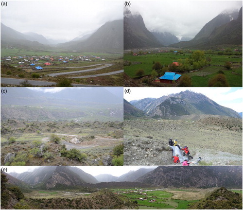
Figure 5. Glacial valley floors as mapped features in color-rendered DEM (a) and in a Google Earth view (b). Cross-section profiles (x, y and z) are illustrated in (c). The locations of cross profiles x, y (glacial valleys) and z (fluvial valley) are marked in (a). The green arrows indicate the flow direction of Parlung Zangbo River. Its location is indicated in .
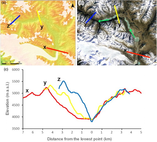
Figure 6. Marginal moraines of the Bodui Zangbo Valley (a) and Quzong Zangbo Valley (b) illustrated as mapped features on color-rendered DEM overlapped with a semi-transparent hillshade images (left) and in a Google Earth view (right). Their locations are shown in .
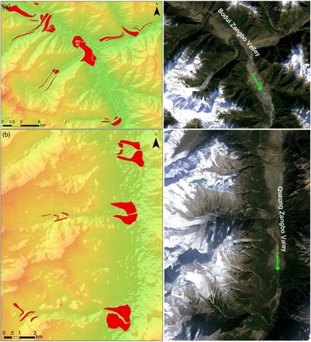
Figure 7. The hummocky moraines in the Bodui Zangbo Valley (a) and the Yigong Zangbo Valley (b) mapped on DEM overlapped with a semi-transparent hillshade images (above), and their Google Earth view (below). Locations of the area depicted are marked in .
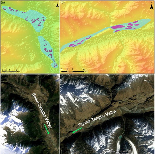
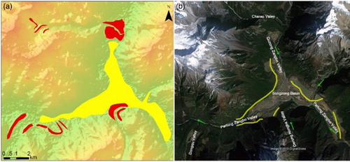
Figure 8. Ice-dammed paleolake as yellow polygon and in Songzong Basin with color-rendered DEM image (left), and Google Earth view (right). Related marginal moraines mapped as poinsettia red. Location is marked in .