Figures & data
Figure 1. Panoramic view of the Buonanotte village hogback ridge and of the Montebello sul Sangro landslide. (a) Upper part and landslide scarp; in the background, the Montebello ridge; (b) lower part and landslide body; in the background, the Bomba Lake.
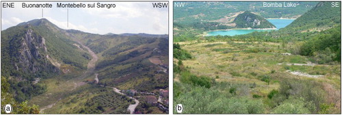
Figure 2. Montebello sul Sangro landslide features: (a) landslide scarp on the calcareous ridge; (b) landslide scarp on the clayey slope covered by scree slope deposits; (c) minor landslide on the western flank of the main landslide on clay units; (d) main earthflow.
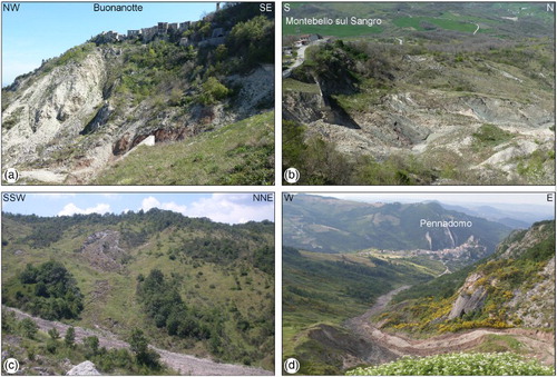
Figure 3. Aerial photos of the Montebello sul Sangro landslide: (a) 1:33,000 scale aerial photos (CitationIGMI, 1954); (b) 1:33,000 scale aerial photos (CasMez, CitationAbruzzo Region, 1974); (c) 1:5000 scale aerial photos and orthophotos (CitationAbruzzo Region, 2009).
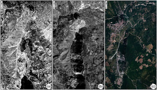
Table 1. Physical and mechanical properties of soils.
Figure 4. LiDAR of the Montebello sul Sangro landslide acquired in January 2014 (1 m resolution) specifically for this project (by CNR-IRPI): (a) shaded relief image; (b) orthophoto.
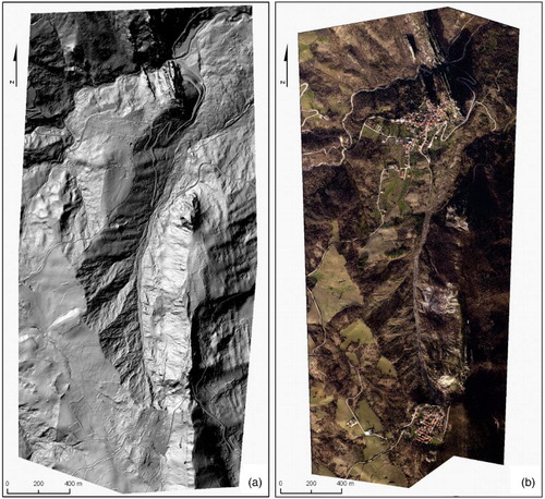
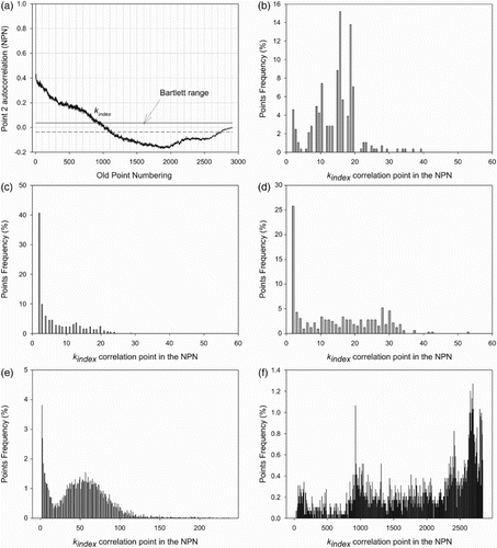
Figure 5. kindex distribution along the whole San Leo basin.
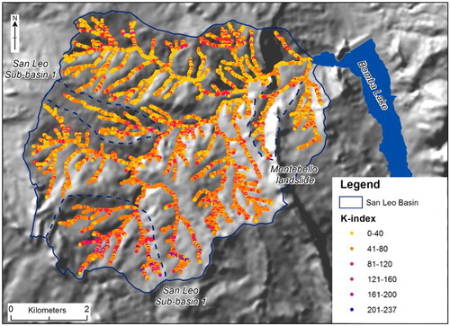
Figure 6. (a) Montebello landslide autocorrelation (5 m resolution); (b) Montebello landslide (25 m resolution); (c) San Leo sub-basin 1 (25 m resolution); (d) San Leo sub-basin 2 (25 m resolution); (e) San Leo basin (25 m resolution); (f) Montebello landslide (5 m resolution).