Figures & data
Figure 1. (a) Cuesta landforms in the São Pedro region. In the background, São Pedro ridge and a glacis. Source: Pinheiro (Citation2014). (b) Diagram of the Upper Paraná Basin.
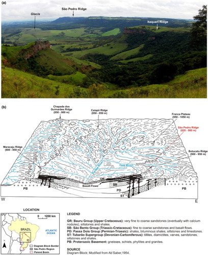
Figure 2. Geological and geomorphological characteristics of the study area.
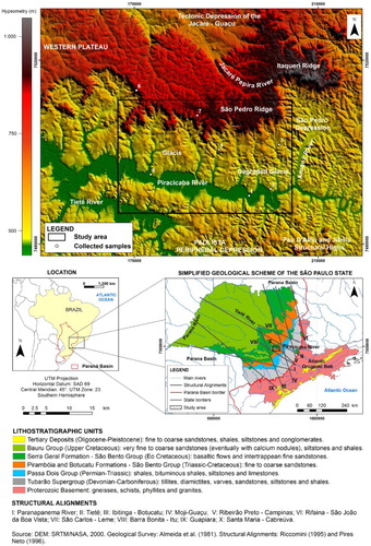
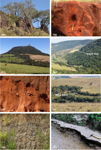
Figure 3. (a) Ruiniform landforms of the São Pedro ridge bottom. (b) Sandy coverture on glacis. (c) Pedra de Torrinha isolated hill. (d) Basalt step in the escarpment. (e) Stone lines in the sandy coverture of the glacis. (f) Slope break in convex-shaped watershed of the glacis. (g) Coarse fluvial sediments of higher fluvial terrace (T1) of the Piracicaba river. (h) Sandy fluvial bar in Piracicaba river tributary. Source: Authors of the photos: Marcos Roberto Pinheiro and Marisa de Souto Matos Fierz.