
Figures & data
Figure 1. Regional geological context, adapted from CitationKotschoubey et al. (2005b).
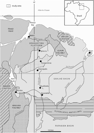
Figure 2. The tree top layers of the geological profile: the bottom of duricrust is columnar while the top of duricrust is nodular; the Belterra clay layer is thin in this area near the convex edge of the plateau (coordinates: −2.9686°/+47.3665°), the common profile observed.
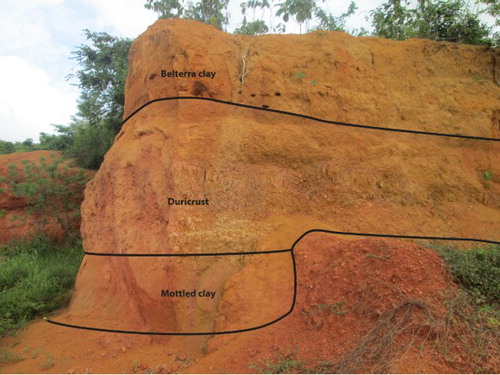
Figure 3. Topographical pattern of the Grajaú region, from CitationKotschoubey et al. (2005b).
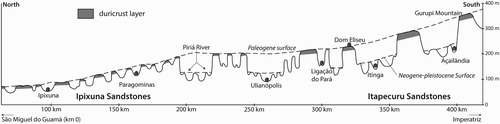
Table 1. Inference rule for texture depending on the difference in elevation to the modelled Paleogene duricrust surface.
Figure 4. Flow chart of field observations and spatial analysis used to compile the map of soil texture.
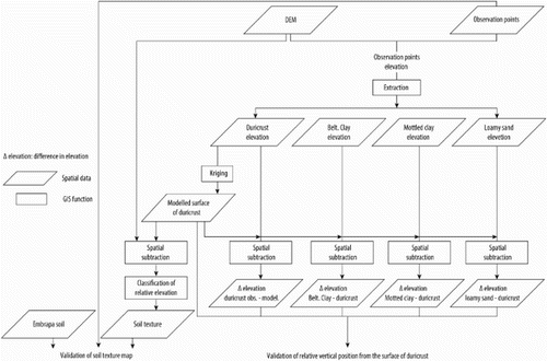
Figure 5. Difference in elevation between the observation points and the interpolated surface of the duricrust.
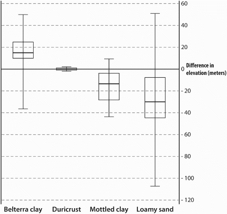
Table 2. Confusion matrix between observations (columns) and map (rows).
Table 3. Results of the spatial overlay of the soil texture map (columns) on the Embrapa soil map (rows), in km2.
Supplemental material