Figures & data
Figure 1. Location and topography of the study area. Locations of the landform examples provided in subsequent figures are indicated by boxes and the numbers refer to the associated figure number. Lakes greater than 100 km2 are shown with blue outlines.
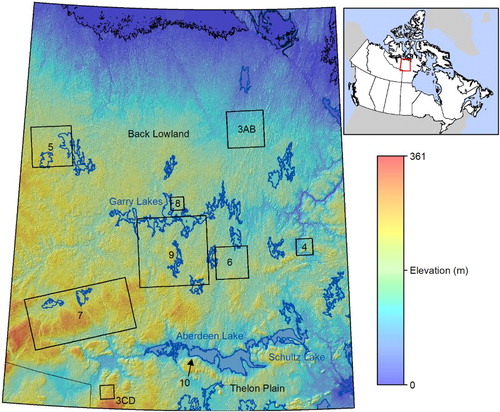
Figure 2. Extent of previous surficial geology maps at various scales in NTS zone 66.
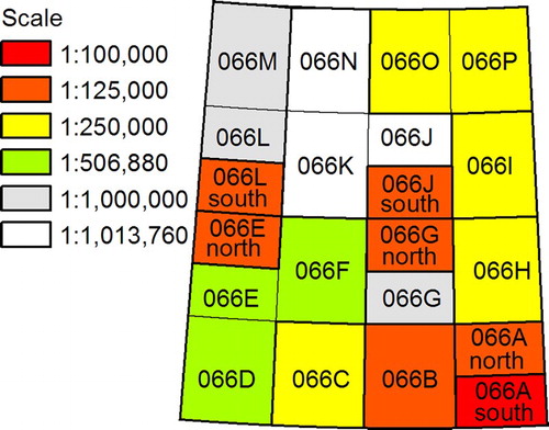
Table 1. Features mapped in previous studies.
Figure 3. Glacial lineations: drumlins shown in (A) CDED and (B) 4,3,2 R,G,B Landsat ETM+ image; and mega-scale glacial lineations shown in (C) CDED and (D) pan-sharpened 4,3,2 R,G,B Landsat ETM+ image. Locations are given in .
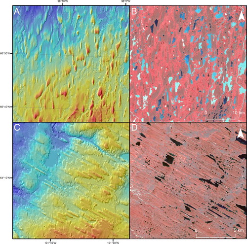
Figure 4. Ribbed terrain shown in (A) CDED and (B) Landsat ETM+ (R,G,B 4,3,2) imagery. Location is given in .
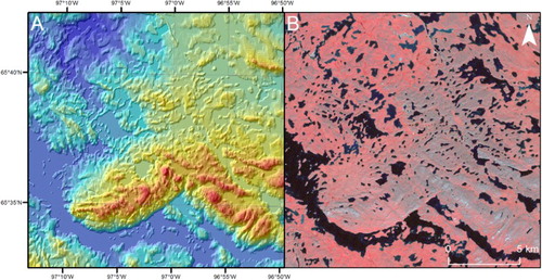
Figure 5. A segment of the MacAlpine moraine (CitationDyke & Prest, 1987) shown in (A) CDED and (B) Landsat ETM+ (R,G,B 4,3,2) imagery. Location is given in .
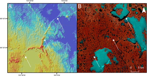
Figure 6. Eskers shown in (A) CDED and (B) Landsat ETM+ (R,G,B 4,3,2) imagery. Location is given in .
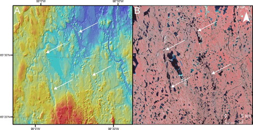
Figure 7. Meltwater channels seen in (A) CDED and (B) Landsat ETM+ (R,G,B 4,3,2) imagery. Location is given in .
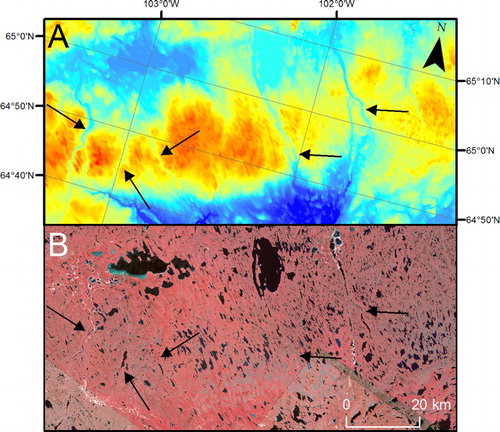
Figure 8. Ice-contact outwash fans/deltas seen in (A) CDED and (B) Landsat ETM+ (R,G,B 4,3,2) imagery. Location is given in .
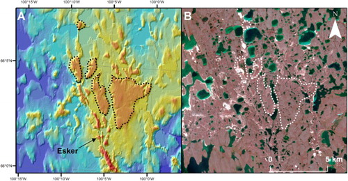
Figure 9. Glaciofluvial deposits. (A) Tracts of glaciofluvial deposits (light colours) between Aberdeen and Garry Lakes shown in Landsat ETM+ (R,G,B 4,3,2) imagery. Location is given in . (B) Close-up of the box in A with outline of mapping. Landsat image is pan-sharpened. (C) DEM showing the same area as B. Note the esker in close association with the glaciofluvial deposits.
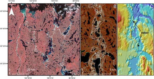
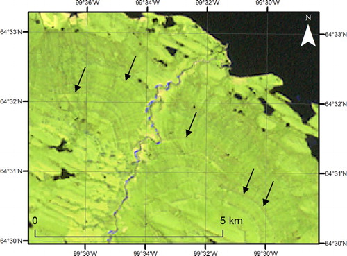
Figure 10. Abandoned lake shorelines (indicated by black arrows) shown in Landsat ETM+ (R,G,B 7,5,2) imagery. Location is given in .