Figures & data
Figure 1. Location map of the study area and 3D view of the Akdag landslide area. Location of landslides on eastern and southern slopes of Mount Akdag were identified from CitationDuman, Can, and Emre (2011).
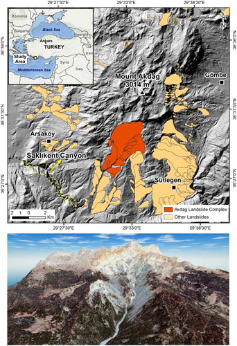
Figure 2. Geology map of the study area (modified after CitationSenel, 1997).
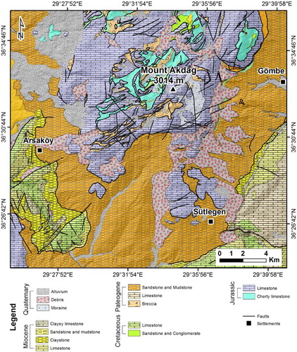
Figure 3. (A) Boundary of landslide (transparent orange color) and UAV-based DSM. Thematic maps derived from UAV-obtained DSM analysis of the sample area (yellow rectangle in (A)); (B) 3D view of the NE section of Akdag landslide obtained from UAV-based orthophoto-mosaics and DSM, (C) Hillshade, (D) Slope, and (E) Aspect.
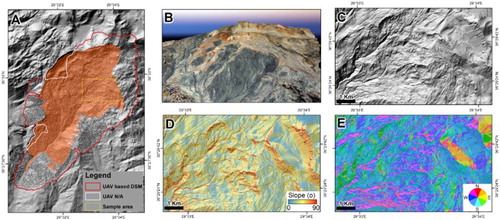
Figure 4. Longitudinal cross-section of Akdag landslide. Yellow line on inset map shows the location of the cross-section.
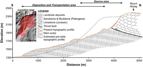
Figure 5. (A) Source area and main scarp of Akdag landslide. (B) Rill and gully channels developed on bodies of secondary slides and earthflows over dark gray clays. (C) Example of new landslide occurrence on the body of former slides.
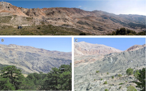
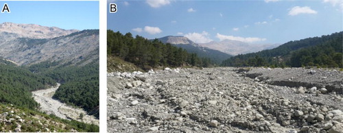
Figure 6. (A) Upper part of Kara Creek, the conduit by which material is transferred downstream from the Akdag landslide complex. (B) Massive aggradation on the upper section of Kara Creek.