
Figures & data
Figure 1. Topographic map of Valles Marineris area from Mars Orbiter Laser Altimeter (NASA/MGS/MOLA Science Team). Area covered by the geomorphological map marked in polygon. Distance bar scale legit for the equator. Abbreviations: Ch. – Chasma, E.Ch. – Echus Chasma, H.Ch. – Hebes Chasma, J.Ch. – Juventae Chasma, O.Ch. – Ophir Chasma.
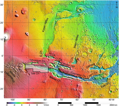
Figure 2. Scheme of mosaic and map preparation procedure.
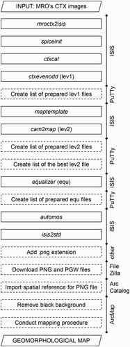
Figure 3. CTX image mosaics prepared in ISIS for Ius Chasma mapping.
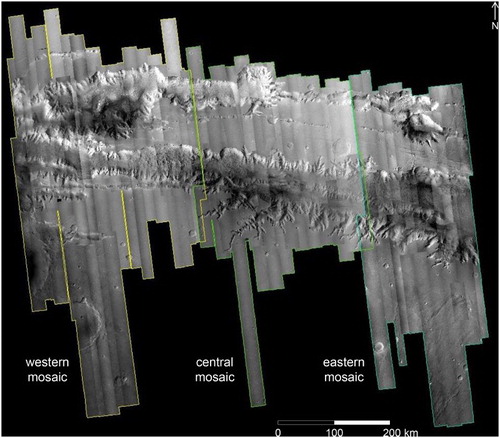
Table 1. The summary of CTX image mosaics produced by ISIS software.
Supplemental material