Figures & data
Figure 1. Aerial photograph extracts (Copyright Ordnance Survey) of: (a) Kilmar Tor and its surrounding boulder-fronted lobes (examples highlighted by dashed black lines). Note the narrow ridge-like tor, which is controlled by local bedrock structure, and toppled blocks that lie at the tor base and grade downslope into lobes; and (b) Rough Tor and its surrounding boulder-fronted lobes (examples highlighted by dashed black lines), showing also the narrow ridge-like main tor and lower height tors and stumps.
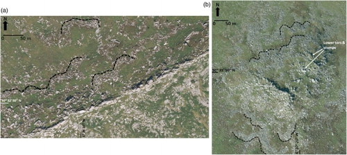
Figure 2. Examples of closely spaced granite pseudo-bedding controlling thin, disc-like blocks in tor stacks and stumps: (a) Rough Tor; (b) Brown Willy.
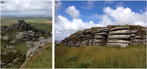
Figure 3. Examples of cantilevered tor stacks: (a) Rough Tor; (b) Sharp Tor.
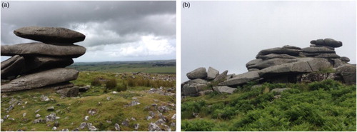
Figure 4. Aerial photograph extract (Copyright Ordnance Survey) of an example of boulder-fronted lobes immediately below the summit of Little Rough Tor. Note that lobes have clear risers (examples outlined by dashed black lines) and treads and lack vegetation cover due to the large sizes and numbers of blocks between which regolith has not developed or accumulated. Tor stumps are visible to top of image and downslope direction is towards bottom right. Note the size and number of the blocks compared to those in .
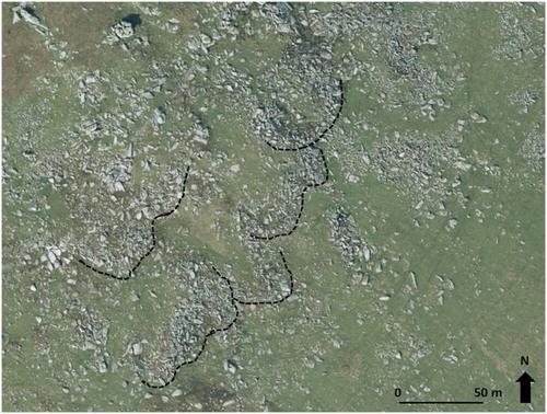
Figure 5. Aerial photograph extracts (Copyright Ordnance Survey) showing examples of different populations of boulder-fronted lobes at lower elevations to those depicted in from the edges of summit blockfields: (a) mid slope (intermediate age) lobes on the northwest slope of Brown Willy, where risers and treads are clearly visible but vegetation is well developed between boulder-fronts (examples outlined by dashed black lines). Downslope is towards the top left; (b) lobes of different appearance and hence age on the southwest slopes of South Rough Tor. Lower slope forms (bottom left) are defined by relatively smaller boulders, and extensive vegetation cover and ill-defined risers. Upper slope forms (top right) comprise steep and wide lobe fronts or risers containing large boulders and sparse vegetation cover (lobe front examples outlined by dashed black lines); (c) older lobes on the lowest slopes to the east of Rough Tor, showing subdued risers (examples outlined by dashed black lines) and well vegetated surfaces.
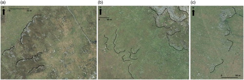
Figure 6. Aerial photograph extracts (Copyright Ordnance Survey) showing striped patterned ground on the intermediate or mid slope to the (a) west and (b) southeast of the Brown Willy summit. The latter shows vegetated stripes.
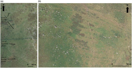
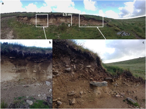
Figure 7. The sedimentary exposure through the valley floor deposits in the De Lank River showing: (a) the architecture of the whole exposure; (b) the two-tiered stratigraphy of upper and lower head; and (c) the crude stratification and discontinuous boulder and gravel horizons in the lower fissile sandy granule gravels overlain by the coarser diamicton (lower and upper head deposits respectively).