Figures & data
Figure 1. Location of the study area in NW Iberian Peninsula (A) and Cantabrian Mountains (B) and its location in relation to the Spanish topographic map at scales of 1:50,000 and 1:25,000. (C) Physiographic features of Lugueros Sheet 104-I.
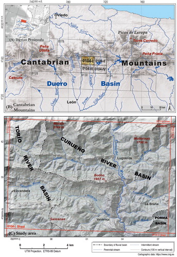
Figure 2. Geology of Lugueros sheet 104-1: rock types: (A) regional geological framerock; (B) age, palaeozoic structures and geologic units of study area; and (C) main lithologies.
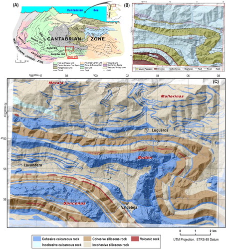
Figure 3. (A) Symbols used in the geomorphological representation and (B) the colour scheme in decimal codes colour of the RBG (red, blue, green) model.
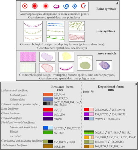
Figure 4. Carboniferous and devonian limestone outcrops in the Sancenas massif showing prominent exokarstic topography. In the highest elevations, as on the northern slope, there are solution channels (A); dolines (B); shafts, uvalas, and poljes (C).
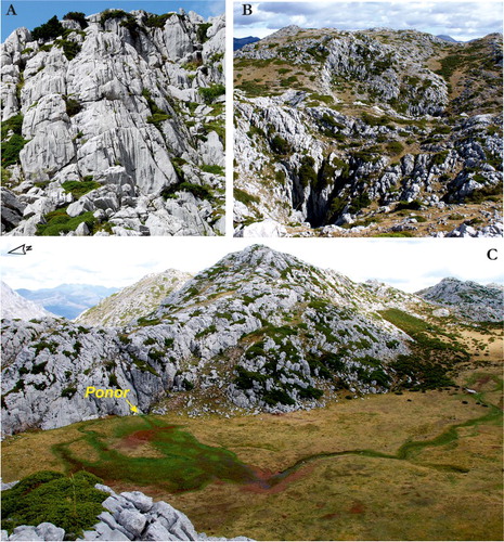
Figure 5. Valdeteja Gorge from the southern slope of Bodón Massif, south of Tolibia de Abajo village. The Curueño River has created a deep north–south-trending gorge in the Carboniferous limestones parallel to bedding.
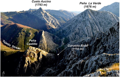
Figure 6. (A) Northern side of Bodón Massif next to Lugueros village with numerous scree and avalanche deposits and snow corridors. (B) Stratified debris flow deposits in the Valdeteja Gorge, east to Valdeteja village (bar length: 2 m).
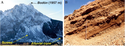
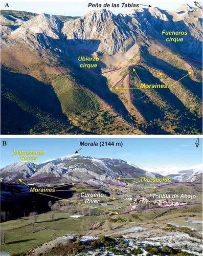
Figure 7. Glacial landforms: (A) cirques and moraines on the Sancenas massif and (B) a system of terminal and lateral moraines near the villages of Lugueros and Tolibia de Abajo.