Figures & data
Figure 1. Palaeogeography of the Maltese archipelago during the LGM.
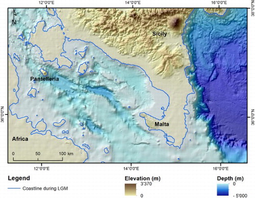
Figure 2. (A) Geographic and tectonic setting of the Maltese archipelago within the Mediterranean Sea. (B) Geological setting of the Maltese Islands and bathymetry surrounding the archipelago (Oil Exploration Directorate, 1993).
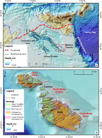
Figure 3. (A) Spatial coverage of bathymetric and LiDAR surveys and location of the study area; (B) flow diagram of the research phases.
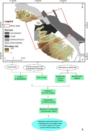
Figure 4. Structural sketch map of northern Malta and Comino.
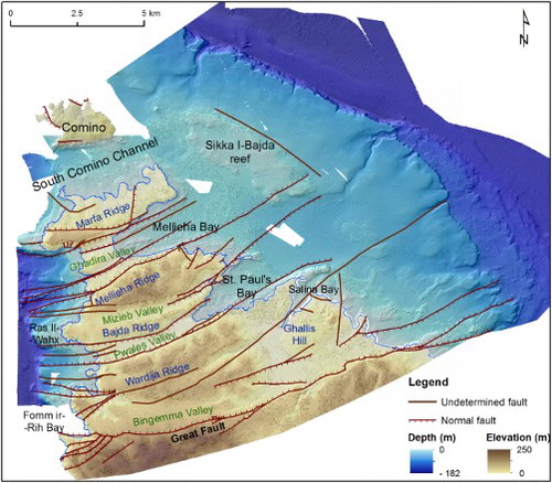
Figure 5. Types of coast occurring along northern Malta and Comino: (A) plunging cliffs, caves and sloping coasts occurring in Comino; (B) sloping coast in Upper Coralline Limestone at Marfa Ridge; (C) shore platform at Blata I-Bajda; (D) plunging cliff at Fomm ir-Rih; (E) scree at Ras in-Niexfa; (F) pocket beach at Ghajn Tuffieha Bay.
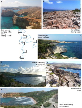
Figure 6. Sketch of emerged and submerged fluvial landforms and deposits (A) and detail of Wied Il-Ghasel (B). location shown be the green square in frame A.
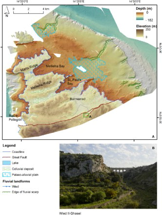
Figure 7. (A) Ta' Randa solution sinkhole; (B) Il-Mansap bedrock collapse sinkhole; (C) submerged bedrock collapse sinkholes located on Sikka Il-Bajda reef.
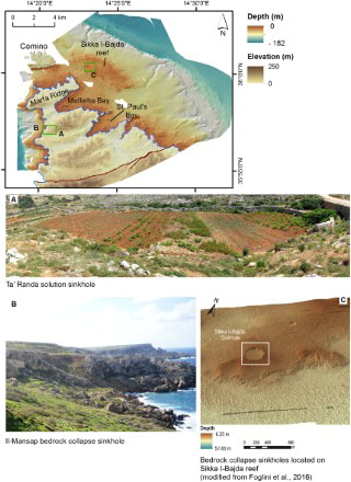
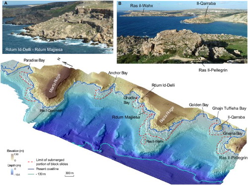
Figure 8. 3D view of the north-western coast Malta affected by landslides prolonging on the seafloor (modified after Soldati et al., in press): (A) southern side of Rdum Id-Delli and Rdum Majjiesa block slides; (B) view of Ras Il-Wahx and Il-Qarraba block slides from Ras Il-Pellegrin promontory.