Figures & data
Figure 1. Overview map. Northeastern Europe with the mapped area in a black dotted box. Elevation data derived from the GEBCO dataset, GEBCO_2014 Grid, version 20150318, www.gebco.net.
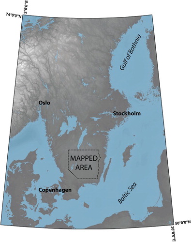
Figure 2. Examples of the variety within the hummock tracts. (A) Semi-ordered ridges transverse to ice flow. (B) V-shaped hummocks. (C) Disorganized irregular hills and depressions. Blue arrows display ice-flow direction from glacial lineations. Background: Hillshade (illumination from 315°) image overlying a colored DEM; brown = low elevation, grey = intermediate, purple = high.
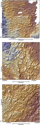
Figure 3. Examples of hummock tracts in corridors with cross profiles A–C and long profiles a–c. (A) Corridor incised into the surrounding streamlined surface. (B) Corridor with a generally positive relief. (C) Corridor marked by scattered hummocks and bedrock topography. Blue arrows display ice-flow direction from glacial lineations. Background: Hillshade image (illumination from 315° on (A) and (B), 90° on (C)) overlying a colored DEM; brown = low elevation, grey = intermediate, purple = high.
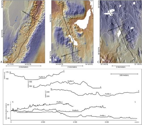
Figure 4. Example of moraines within the mapped area. (A) Part of the Vimmerby Moraine with a N–S direction. Note the different directions and cross-cutting relationships of glacial lineations outside and inside the moraine. (B) Sub-continuous moraine with a lobate shape in an E–W direction. Orange arrows mark moraines. Blue arrows display ice-flow direction from glacial lineations. Background: Hillshade image (illumination from 45°) overlying a colored DEM; brown = low elevation, grey = intermediate, purple = high.
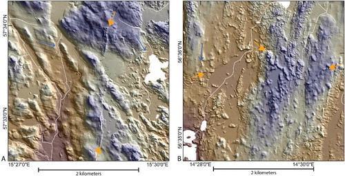
Table 1. More than 20,000 features where mapped. The sum and individual count of all mapped landforms are presented in this table.
Figure 5. Examples of landscape position of glacial lineations. (A) Glacially streamlined surface. (B) Streamlined landform overlain by hummocks. (C) Subtle streamlined landforms superposed on hummocks. Blue arrows display ice-flow direction from glacial lineations. Background: Hillshade image (illumination from 45° on (A), 315° on (B), 90° on (C)) overlying a colored DEM; brown = low elevation, grey = intermediate, purple = high.
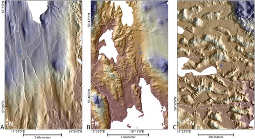
Figure 6. Visualization of glacial lineation. (A) Glacial lineations colored by direction; green = westerly ice flow, yellow = southerly ice flow, red = easterly ice flow. (B) Glacial lineations colored by length; blue = short lineations, yellow = intermediate, red = long lineations.
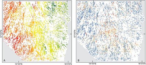
Figure 7. The mapped extent of hummock tracts display (undifferentiated = yellow, ribbed moraine = brown) a radial pattern parallel to the overall ice-flow direction.
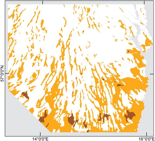
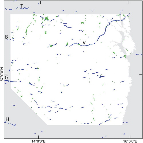
Figure 8. End moraines (blue) and deltas (green) reflect former ice margins. Trollhättan Moraine (T) can be connected with a series of lobate moraines in its continuation. A connection between the Berghem Moraine (B) and Vimmerby Moraine (V) is noticeable. The Göteborg Moraine (G) can be extended to moraine fragments to the east. H = Halland coastal Moraines.