Figures & data
Figure 1. Structural sketch map of the Western Alps (modified from CitationBigi et al., 1990). The red inset shows the area represented in the Main Map.
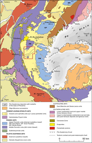
Figure 2. (a) The composite DSGSD of Sauze d’Oulx in the Susa Valley. Jv: Jouvenceaux sector; Sp: Sportinia sector; Rc: Richardette sector. The Dora Riparia alluvial plain is visible in the foreground. Photo taken from Monte Pramand (2163 m a.s.l.), view looking SSE. (b) The DSGSD of San Sicario in the Susa Valley. The Dora Riparia River is visible on the left. Photo taken from Punta Rascià (2346 m a.s.l.), view looking NE.
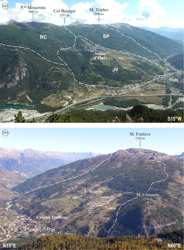
Figure 3. (a) Panoramic view of the Ripa Valley. Main complex landslides are highlighted with dashed lines. A: Roche Rouge; B: Champlas Seguin; C: Champlas Janvier; D: Champlas du Col; E: Grange Sises; F: Bessen Haut; GRF: Gran Roc Fault. Photo taken from Punta Rascià (2346 m a.s.l.), view looking ENE. (b) The Monte Pelato rock slide in the upper Chisone Valley. The Chisone River is visible in the foreground. Photo taken from La Grande (2606 m a.s.l.), view looking Est.
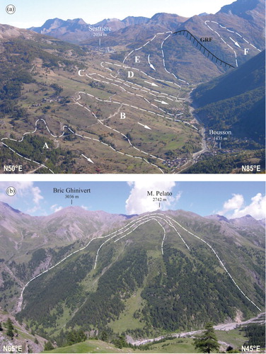
Figure 4. The Monte Ciantiplagna rock avalanche. The alluvial plain formed as a consequence of the blockage of the Chisone River is visible in the background. Arrows indicate the travel path of the rock avalanche. In the center of the image is visible the deep gorge carved by the Chisone River. Photo taken from the Serre Marie fort (2109 m a.s.l.), view looking West.
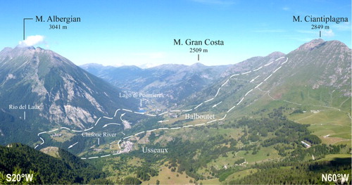
Figure 5. (a) Impressive uphill-facing scarps along the Susa-Chisone drainage divide at Colle dell'Assietta. The Susa Valley is visible on the left of the image. Photo taken from Testa dell'Assietta (2555 m a.s.l.), view looking NE. (b) Hectometric long uphill-facing scarp along the south-eastern slope of the Monte Genevris. The Chisone Valley is visible on the right. Photo taken from Monte Genevris (2533 m a.s.l.), view looking ENE.
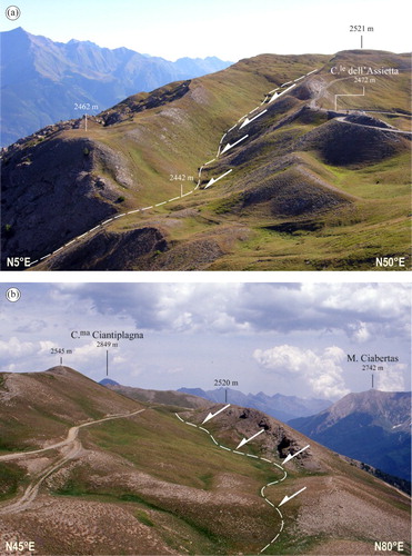
Figure 6. (a) Multiple-crested ridge along the northern slope of the Cima delle Vallette, along the Susa-Chisone divide. The Susa Valley is visible on the left of the image. Photo taken from Gran Pelà (2705 m), view looking East. (b) Multiple-crested ridge on the northern slope of the Monte Ciantiplagna, along the Susa-Chisone divide. The Susa Valley is visible on the left of the image. On the bottom left is visible the huge closed depression (130 m long and 15 m deep) of Colle delle Vallette. Photo taken from Cima delle Vallette (2705 m), view looking East.
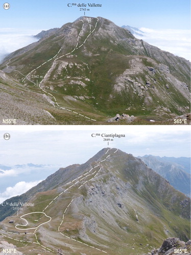
Figure 7. (a) Multiple-crested ridge along the Clot della Soma–Monte Morefreddo divide. The Chisone Valley is visible in the background. Photo taken from the NW ridge of Monte Morefreddo (2599 m a.s.l.), view looking NW. (b) Impressive closed depression (120 long and 15 m deep) along the eastern side of the Punta Rascià–Cima Saurel ridge, in the upper Susa Valley. Photo taken from Serre Granet (2294 m a.s.l.), view looking East.
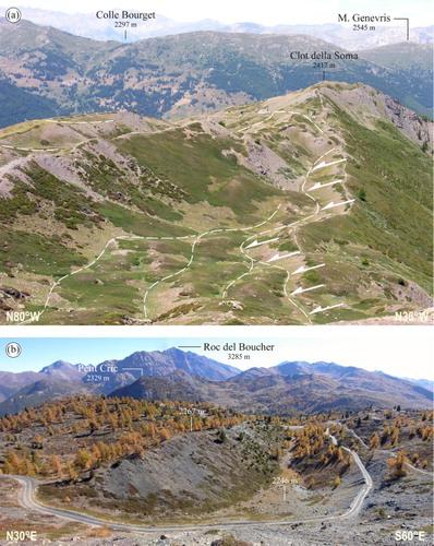
Figure 8. (a) Multiple downhill-facing scarps along the northern slope of the Monte Triplex (Susa Valley). Photo taken from Rocca Nera (2479 m), view looking West. (b) Downhill-facing scarps along the southwestern slope of Rocce Platasse, in the upper Susa Valley. Photo taken from Rocce Platasse (2817 m), view looking SW.
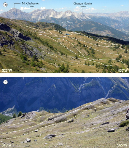
Figure 9. Schematic representation of the relationship between morphostructural features induced by DSGSDs and glacial, periglacial and slope deposits as observed in the study area.
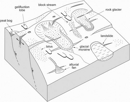
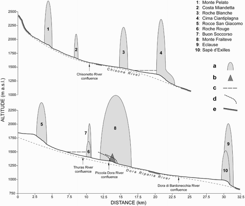
Figure 10. Longitudinal profiles of the Chisone and Dora Riparia rivers in the study area. (a) DSGSD and landslide accumulation; (b) alluvial fan; (c) ancient lake level; (d) late-glacial end-moraine profile and (e) exposed bedrock along river bed.