Figures & data
Figure 1. (a) Enticho Sandstones outcrop near Sinkata village (south of Adigrat city); (b) eolian faces of the Enticho Sandstones near Adigrat city; (c) stratigraphic contact between Edaga Arba Glacials (bottom) and Enticho Sandstones near Wukro village; (d) Edaga Arbi Glacials outcrop near Wukro.
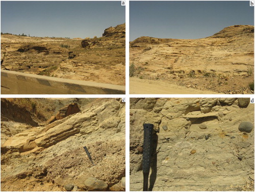
Figure 2. (a) Map of the thickness of the Adigrat Sandstones resulted from the subtraction (in GIS environment) of the top (Antalo Limestones/Adigrat Sandstones contact) and the bottom (Adigrat Sandstones/Basement rocks contact) surfaces of the formation mapped by using field work data and the published geological maps (SRTM DEM database); (b) Adigrat Sandstones outcrop west of Wukro city.
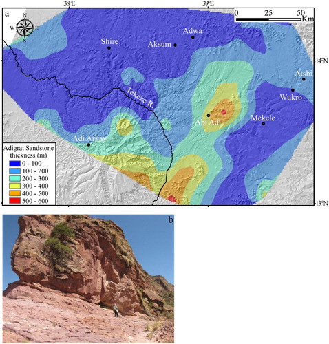
Figure 3. (a) Sub-horizontal Antalo Limestones near Mekele city (Mekele outlier); (b) Agula Shales outcrop near May Keyih, SE of Mekele; (c) Amba Aradam Formation outcrop south of Mekele; (d) laterite deposit lying on top the Amaba Aradam Formation south of Mekele.
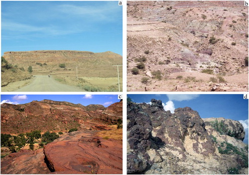
Figure 4. (a) Sub-horizontal Trap basalts near May Tsemre village, immediately north of Adi Arkay; (b) plugs east of Aksum.
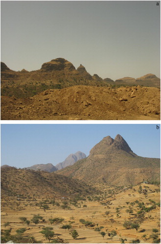
Figure 5. (a) Map of the dorerite outcrops (zoom from the Main Map); (b) dolerite dike intruded in Agula Shales near Mt. Amba Aradam (Mekele outlier); (c) dolerite deposit lying on top the Agula Shales immediately east of Mekele city.
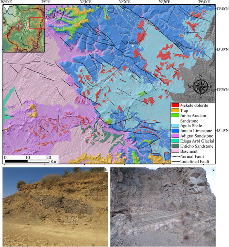
Figure 6. (a) Folds in the basement rocks located east of Tekeze River valley (in the background) around 13°29′N, 38°45′E; (b) domino faulting in basement rocks near Abi Adi village: the faults (in red) appear truncated by an angular unconformity (white) on the top.
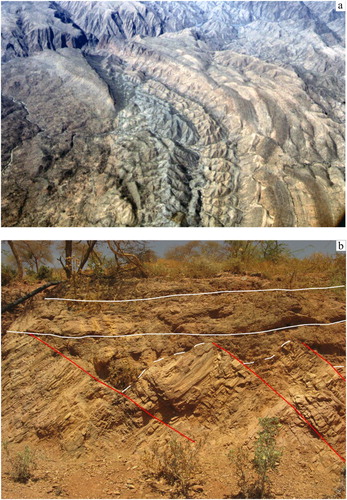
Figure 7. Geological configuration of the Wukro area (zoom from the Main Map).
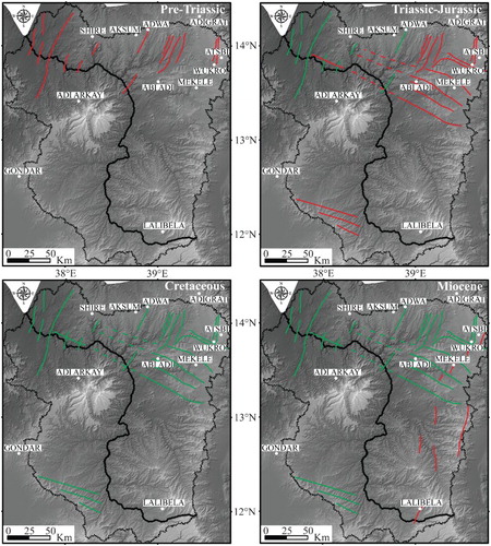
Figure 8. Model of the tectonic evolution of the Tekeze basin since Pre-Triassic up to the Miocene. Red lines indicate the active faults while the green ones evidence the inactive tectonic lineaments. The dashed lines represent the inferred faults.