
Figures & data
Figure 1. Study area (red polygon). Lower Magdalena region, Cundinamarca, Colombia.
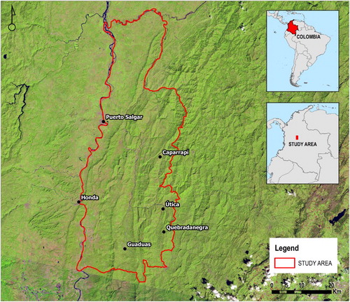
Figure 2. Pre-processing and processing chain performed in this study (integrated radar–VNIR dataset).
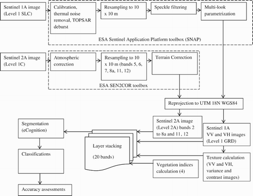
Table 1. Overall accuracy and kappa index for the SVM, Random Forests and k-NN classifications applied to the three dataset configurations used in the study.
Table 2. Confusion matrix and classification accuracy measures of the integrated datasets SVM-classified map.
Supplemental material