Figures & data
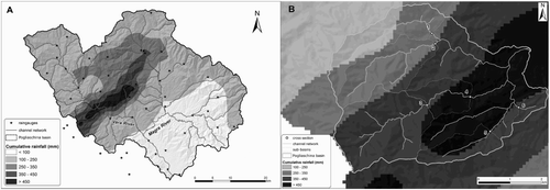
Figure 1. (A) Map of cumulative rainfall for the rainstorm of 25 October 2011 in the Magra River basin, modified from CitationRinaldi et al. (2016). (B) Zoom on the Pogliaschina basin; the numbers (1–6) indicate the outlet of six sub-basins where peak discharge has been estimated.