Figures & data
Figure 1. Schematic representation of the five units identified in the ultramafic medium. The red line separate lithologic units with homogeneous characteristics (modified from CitationSegadelli et al., 2017).
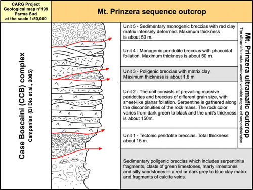
Figure 2. Peridotites with sheet-like planar foliation, main aquifer (PSF unit).
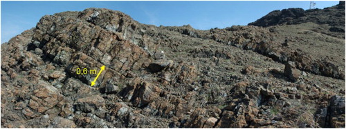
Figure 3. Polygenic breccias composed of blocks of light gray limestone or marly limestones and marly limestone gray-green fragments held together by a fine-grained matrix or a mineral cement (PB unit).
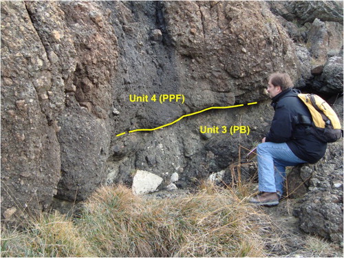
Figure 4. Predominantly poligenic breccias (aquitard, PB unit) at the contacts with the ultramafites of Mt Prinzera (Case Boscaini complex, Campanian age).
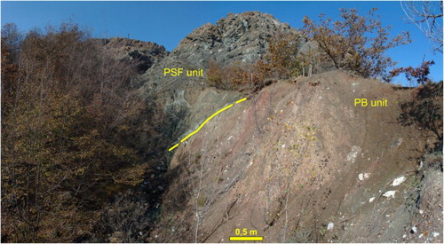
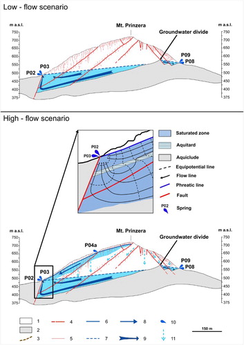
Figure 5. Hydrogeologic conceptual model of the Mt Prinzera aquifer system. Legend – 1: ultramafic aquifer; 2: aquiclude; 3: discontinuous aquitard; 4: fault; 5: fracture; 6: perched groundwater phreatic surface; 7: basal groundwater piezometric surface; 8: flow line of the perched groundwater; 9: flow line of the basal groundwater; 10: springs and their code; 11: infiltration within the unsaturated ultramafic medium.