
Figures & data
Figure 1. The Italian coastal areas are characterized by important human settlements that are sensitive to sea level rise: (a) the Fondi Plain, near Latina (Latium, Italy) is one of the 33 areas of the Italian coastal zones prone to marine flooding (CitationLambeck et al., 2011) (Photo G. Mastronuzzi, 2005); (b) the Mouth of Carapelle river, near Foggia (Apulia, Italy) with damaged wetlands after the sea-storms occurred on February/March 2009 (Photo by M. Caldara, 2009).
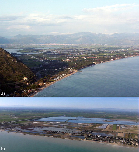
Figure 2. Sea level rise projections for 2100, as proposed by the IPCC 2013 report.
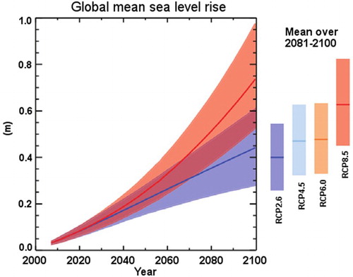
Figure 3. The four Italian areas investigated in this study, characterized by coastal plains and geo-diversity.
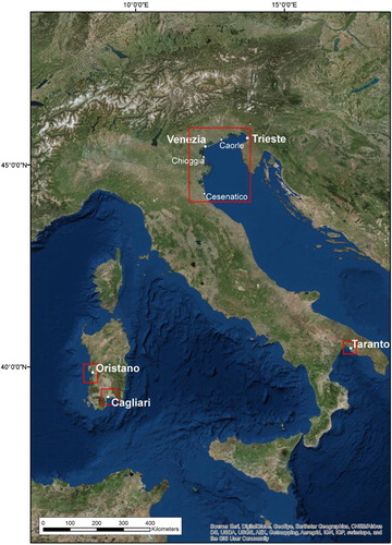
Table 1. (1) The investigated areas: the northern Adriatic area is distinguished according to the different tectonic and isostatic rates here presented. (2) Long-term tectonic rates and (3) relative references. (4) Isostatic rates and (5) reference. (6) Period of LIDAR survey and (7) the Agency that produced the DTM used in this study.
Table 2. Vertical land motion rates obtained from the historical and recent GPS stations.
Table 3. Sea level rates for the ISPRA Tidal network and historical stations with the relative time span.
Table 4. The map limits for each area are reported as projections (WGS84_UTM 32/33N) together with both the main map and inset map scale.
Supplemental material