Figures & data
Figure 1. Geographic and geodynamic setting of the Maltese Archipelago (central Mediterranean Sea).
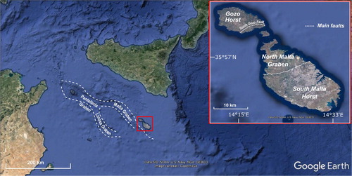
Figure 2. Geology of the Island of Gozo (CitationOil Exploration Directorate, 1993) and location of the study area.
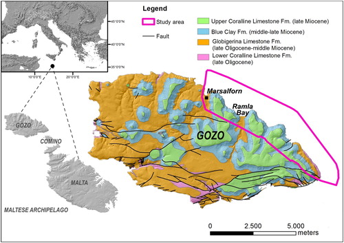
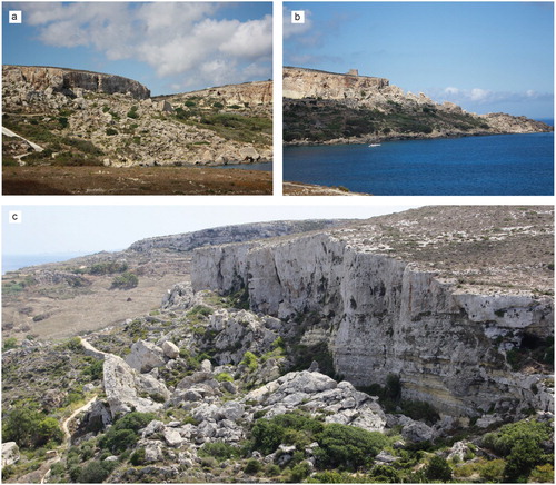
Figure 3. Coastal geomorphotypes: (a) built-up coast (Marsalforn Bay); (b) cliff shaped in Blue Clay (east of Marsalforn Bay); (c) sloping coast (between Dahlet Qorrot Bay and Ras il-Qala); (d) plunging cliff (between Dahlet Qorrot Bay and Ras il-Qala); (e) scree (Gebel Mistra); (f) shore platform (east of Marsalforn Bay); (g) pocket beach (Ramla Bay).
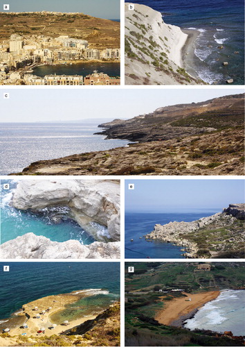
Figure 4. Ramla Wied during different periods: (a) and (c) the temporary stream is full after an intense rainy period (November 2017); (b) the valley is dry (September 2017) and hosts sediments and vegetation and a succession of alluvial sediments is observable on a side of the small fluvial scarp. In frame (d) Ramla Bay (seen from the north) during a flash flood occurred on 15 November 2012; the abundance of transported sediment is noticeable.
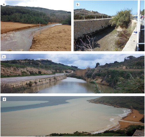
Figure 5. Landslides: (a) block slides (west of Dahlet Qorrot Bay); (b) earth flow and block slide (between San Blas Bay and Dahlet Qorrot Bay); (c) rock fall at the bottom of a limestone plateau and earth flow/slide affecting the underlying clayey terrain (between San Blas Bay and Dahlet Qorrot Bay).