
Figures & data
Figure 1. Red-cyan anaglyphs are created by overlaying adjacent aerial photographs from a survey flight. Images are digitally filtered using the RGB (Red-Green-Blue) channels.
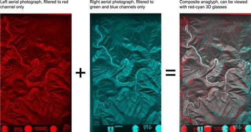
Figure 2. Location map, showing the Snowy Mountain region, southeast Australia, and the approximate area covered by and .
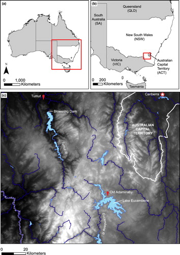
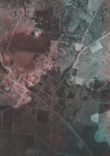
Figure 3. ‘Tumut River (1944)’, showing an active river with meander cutoffs and abandoned channels, and a shadow indicating the footprint of the reservoir that would later be impounded behind the Blowering Dam wall.

Figure 4. ‘Old Adaminaby (1944)’, showing the town of Old Adaminaby, a shadow indicating the footprint of the future Lake Eucembene.
Supplemental material