
Figures & data
Figure 1. Geological scheme of Genoa Municipality and location maps.
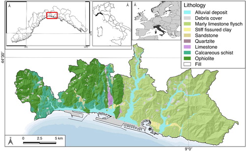
Figure 2. The population trend in Genoa municipality from 1861 (data from Genoa Municipality).
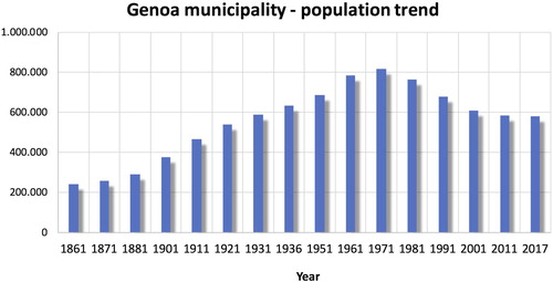
Figure 3. The spatial distribution of the cultural heritages in Genoa Municipality, selected by the regional and municipal data. Municipality does not include all the hydrographical networks and catchments.
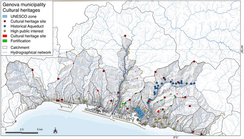
Table 1. Main flood and landslide events in Genoa Municipality in the period after the WWII (Faccini et al., 2015).
Figure 4. The dark blue bars show monthly average rainfall in the period 1961–2010 (data of the meteorological station Genoa – University from ARPAL, 2013); red dots show the monthly distribution of geo-hydrological events in the period 1950–2016.
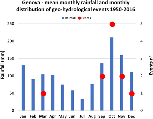
Table 2. Data used for the analysis and for the drawing of the map. The DTM is the more recent available, like all the other layers.
Table 3. Cultural heritages in Genoa Municipality.
Figure 5. Damage after 2014 flood in the Bisagno catchment; A, B near the train station; C, D solid transport and riverbank collapse along Geirato stream, a Bisagno river tributary (refer to the scheme in the Main Map).
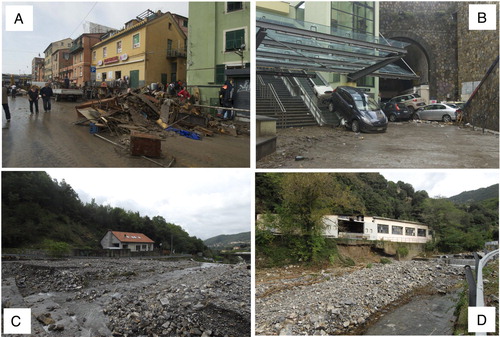
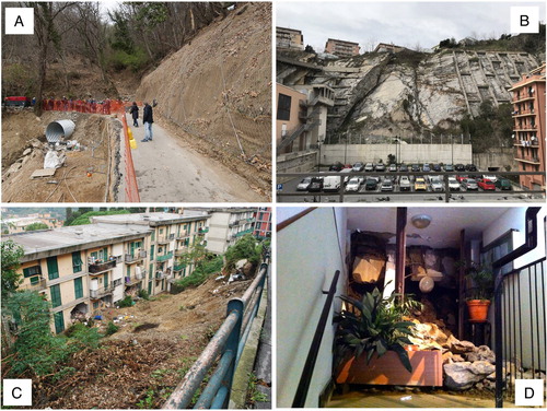
Figure 6. Landslides in the Municipality: A, road interruption in the upper Urban unit 12; B the actual status of the via Digione collapse landslide (u.u. 27); Clandslide affecting a residential building and a road; D of a landslide strongly affected apartment in 2014 (district 15).