Figures & data
Figure 1. (a) Geographical localisation of the study area; (b) geological map of the central Apennines showing the main stratigraphic-structural domains; (c) geological setting of the Amatrice Basin (modified and readapted after CitationMariucci, Montone, & Pierdominici, 2010).
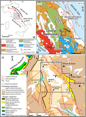
Figure 2. – Eastward panoramic view of the surveyed area with indication of the Amatrice village, in the foreground, and the trace of the Gorzano Fault, in the background.
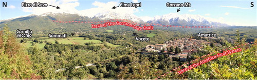
Figure 3. (a) Selected stratigraphic logs and (b)-(i) field exposures used for reconstructing the general stratigraphy; (b–c) Retrosi Unit (URT): clast-supported conglomerates and gravels; (d) Amatrice-Sommati Unit, sandy member (UASs): yellowish massive-to-slightly bedded sands with silty matrix; (e–f) Amatrice-Sommati Unit, conglomeratic member (UASc): tabular conglomerates and gravels; (g–h) Laga Formation, siltstone-dominated lithofacies (LAGp): well bedded, centimetre-to-decimetre-thick planar beds of beige siltstone; (i) Laga Formation, sandstone-dominated lithofacies (LAGa): massive tabular and lenticular beds of grey to brown, medium-sized sandstone.
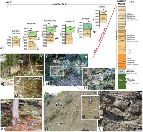
Figure 4. Stereographic projections (Schmidt net, lower hemisphere) for (a) the bedding of the Laga Formation and (b) the normal faults detected in the study area.
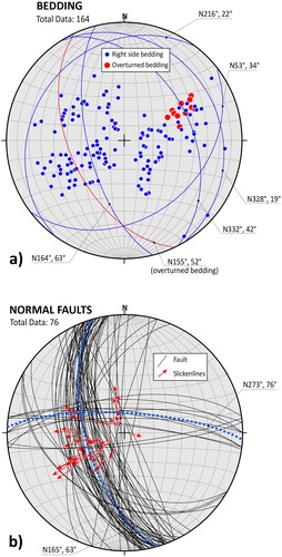
Figure 5. Location of the geological cross-sections presented in Figures A4, A5.
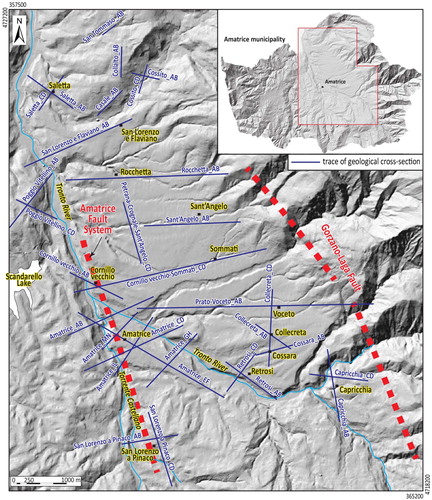
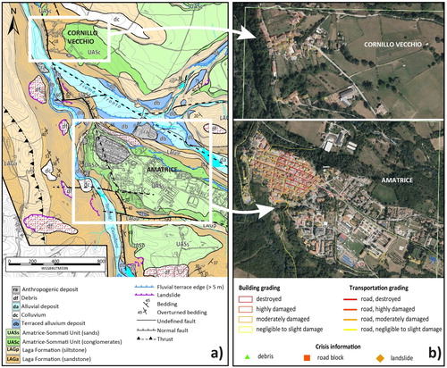
Figure 6. (a) Extract of the 1:5,000 scale geological map (see the Main Map; Figures A1–A3) used for comparison with the (b) damage pattern (buildings, roads, and crisis information) detected after the first seismic sequence (on 24th August 2016). Grading maps are available at http://emergency.copernicus.eu/mapping/list-of-components/EMSR177.