Figures & data
Figure 1. Study area, highlighted with the red square, within the northern Mediterranean – Alpine region.
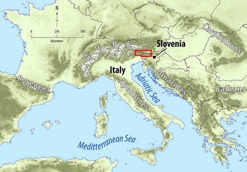
Figure 2. (a) The extent of Brica (n. 47 in the Main Map), del Cason (n. 45) and dell’Inferno (n. 46) rock glaciers as seen from the shaded relief projected on the 1 m cell size DTM in 3D view, (b) vegetation cover as seen from the ortophoto projected on the shaded relief in 2D view, and (c) their typical morphology resembling the lava flow shown on the shaded relief in 2D view.
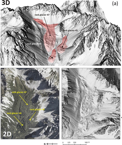
Table 1. Field-based observations of ice content (%) by rock glacier volume reported in the literature.
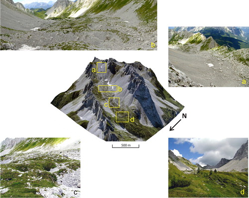
Figure 3. 3D image of Tiarfin rock glacier (n. 23 in the Main Map) realized by projecting the 2008 ortophoto on the 1 m cell size DTM. Details of different parts of this landform are highlighted in the Squares: (a) protalus ramparts located at the highest elevation of the rock glacier complex; (b) the central part where several ridges and furrows are clearly visible also from the field; (c) small dolines over the rock glacier surface likely due to thermokarst activity or suffosion; (d) the vegetated frontal part of the rock glacier with small Larix and Pinus mugo.