Figures & data
Figure 1. (a) Geological Sheet Tehuacán location at southern Mexico, at the border area between Puebla and Oaxaca states. (b) The area in brown color corresponds to the Geological Sheet Tehuacán (14Q-i-(10)), it is referenced to 1:100,000 scale UTM cartographic grid.
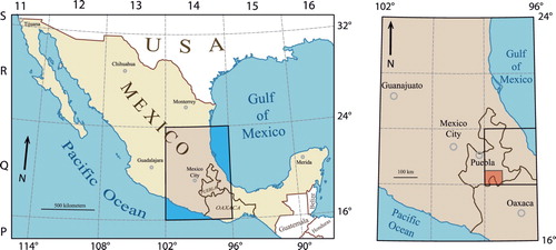
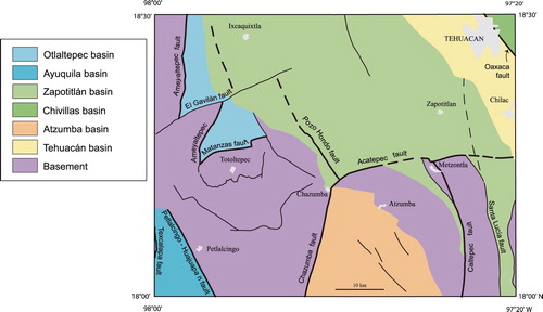
Figure 3. Spatial distribution of the six tectonic basins mentioned in the work and the faults that delimit them. The major Caltepec fault that juxtaposes the Mixteco (western block) and the Zapoteco (eastern block) tectonostratigraphic terranes (CitationSedlock, Ortega-Gutiérrez, & Speed, 1993) is also shown. The Oaxaca fault delimits the Chivillas and Tehuacán basins, and is the boundary between the Zapoteco and the Cuicateco tectonostratigraphic terranes (CitationSedlock et al., 1993).