
Figures & data
Figure 1. Flowchart demonstrating steps in preparation of the map of ecosystems.
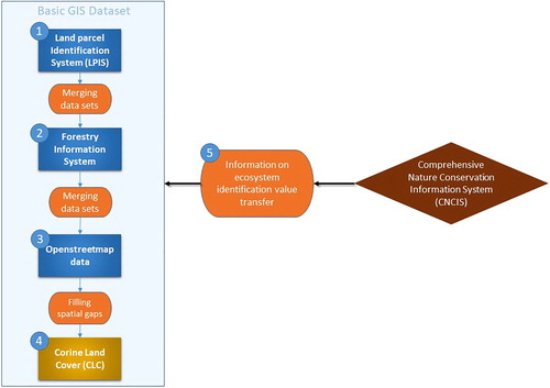
Figure 2. Match of the boundaries and identified ecosystems with field data survey.
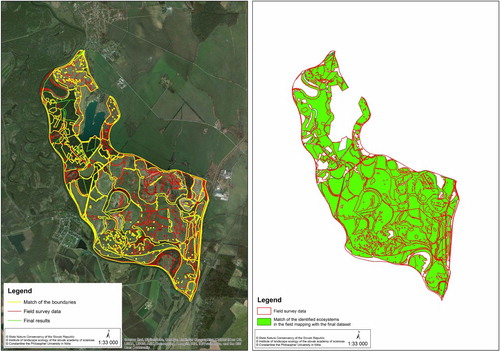
Table 1. Overlap of field data survey (Reference area) with the final data set.
Figure 3. Example of error reduction in data set by removal of non-forest part previously defined as forest habitat.
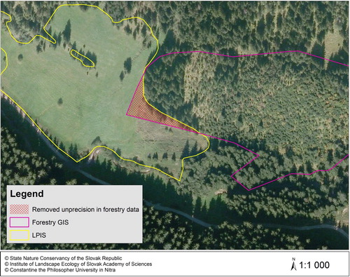
Figure 4. A selection of the prepared ecosystem map for the Bratislava region (the EUNIS level 3 habitat names, frequencies, and covered areas are given in annex 2).
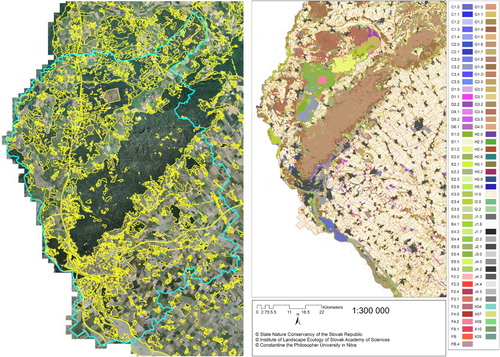
Figure 5. The ecosystem map for another region of Slovakia (Žilina region).
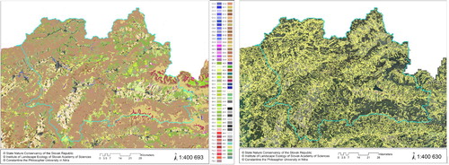
Table 2. Number of habitat types at the different EUNIS levels in the ecosystem map.
Table 3. Overview of EUNIS habitat level 1 categories, and their frequency, area and coverage (in %) of the national territory.
Supplemental material