
Figures & data
Figure 1. Flowchart of the cartographic procedure used to determine spatial accessibility.
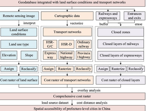
Figure 2. Datasets of land surface conditions and transport networks used to calculate spatial accessibility.
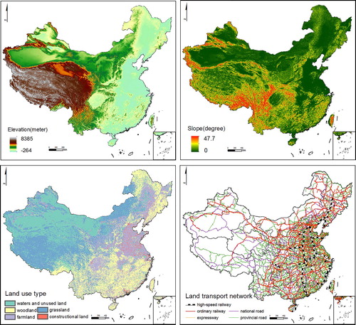
Table 1. Traveling speeds of cells with different attributes.
Supplemental material