Figures & data
Figure 1. Location map of Antarctica (A), Antarctic Peninsula (B) and Horseshoe Island (C).
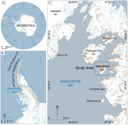
Figure 2. Geological map of Horseshoe Island on Google Earth Image. Date of the image is 2012. Lithological, tectonics and structural features are adapted from CitationMatthews (1983).
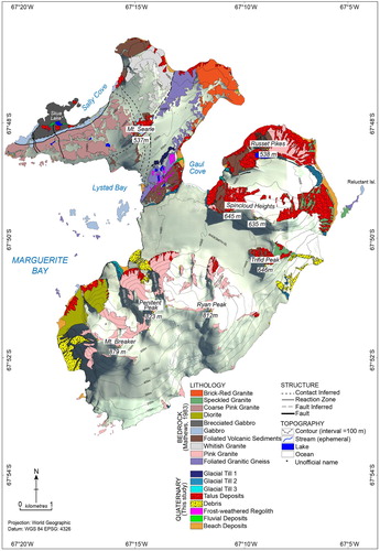
Figure 3. (A) General view of Horseshoe Island from the west, (B) View southern part of Searle Ice Cap from Central Col, (C) View of Moraine 1 ridge and Col Lake 3 from south. (D), An example of erratic boulders, (E) Ice striations on bedrock surfaces.
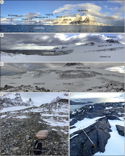
Figure 4. Panoramic view of Lystad Bay branch of (A) Shoesmith Glacier, (B) Terminal and (C) Lateral moraines of Shoesmith Glacier.
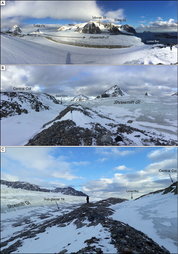
Figure 5. (A) General view of Erinç Glacier, (B) Close-up view of moraine ridges in front of the Erinç Glacier, (C) An example of pink granite boulder within the till.
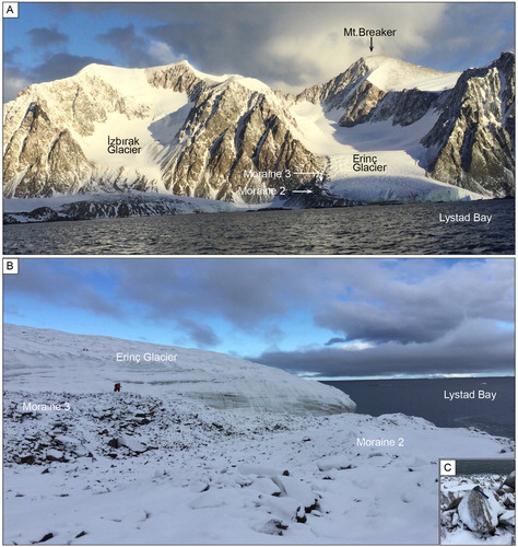
Figure 6. (A) An example of frost-shattering of a single block, (B) frost-shattering of the bedrock surfaces. (C–E) sorted stone polygons with different lithologies, (F) unsorted polygon type patterned grounds.
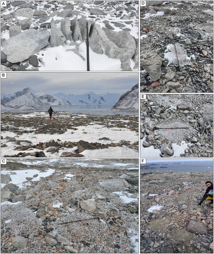
Figure 7. (A) General view of truncated spurs and talus fans at the western flank of the southern sector, (B and C) boulder and sand-size clasts in taluvium, (D) Oblique view of the talus cones, protalus ramparts, rock ploughing, solifluction sheets and rock slide tongue (see Main Map for location of protalus rampart).
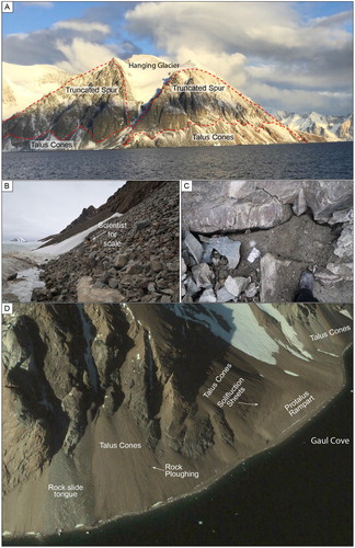
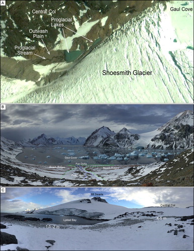
Figure 8. (A) Google Earth view of the proglacial stream, outwash plain and proglacial lakes in front of the Shoesmith Glacier, (B) General view of the raised beach ridges and fan delta at the Gaul Cove. Dashed blue lines indicate ephemeral streams and dashed green lines delimit boundary between raised beach ridges and flood plain and fan delta, (C) General view of the raised beaches at the Lystad Bay.