
Figures & data
Figure 1. Location map. Pictured Rocks National Lakeshore is located along the southern shore of Lake Superior in the Upper Peninsula of Michigan.
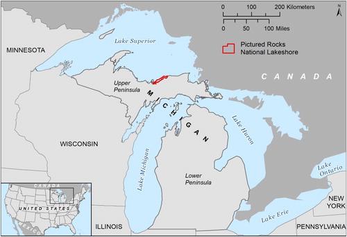
Figure 2. Regional elevation and 7.5-minute quadrangle references. Highest elevations are in white and tan, and lowest elevations are in teal. Pictured Rocks National Lakeshore is located in Alger county and almost fully incorporated within the ten distinguished 7.5-minute quadrangles.
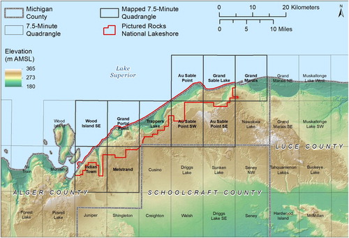
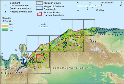
Figure 3. Locations of sediment classifications (372 sites) for surficial geology mapping and passive seismic data collection sites (347 total). Sediment classification sites with ‘X’ designate samples used in textural analysis.
Supplemental material