Figures & data
Figure 1. Geographical location of the study area.
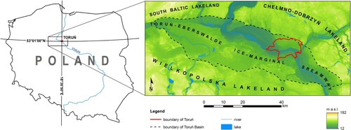
Figure 2. Toruń Panorama from the NE, from Georg Friedrich Steiner’s drawing from the first half of the eighteenth century (CitationBiskup, 1998), showing the non-existent today Baker’s Hill (No. 1) and preserved to this day, partly transformed Front Hare Hill (No. 2).
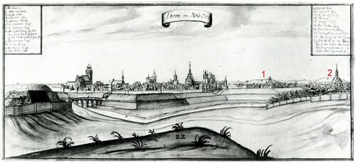
Figure 3. Examples of analysed historical and contemporary plans and maps from 1793–2000 covering part of the western suburbs of the city, showing the destroyed Gold Hill (No. 1) and Baker’s Hill (No. 2) and the partly transformed Front Hare Hill (No. 3) (source: State Archives in Toruń; Faculty of Earth Sciences, Nicolaus Copernicus University in Toruń).
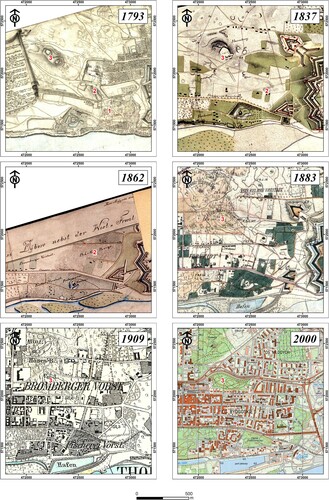
Figure 4. Historical photographs of Toruń: A – part of the Chełmińskie suburb of Toruń of the 1920s, taken from a military observation balloon (source: Regional Museum in Toruń), the picture shows loose eolian sands not covered with vegetation; B – Toruń and surroundings seen through the American reconnaissance satellite Corona 98 (KH-4A 1023) on the 23rd of August 1965 (source: US Geological Survey via Wikigrant number WG 2014-52); the picture shows dunes and eolian sands not covered with vegetation as irregular patches of bright phototones outside the built-up area.
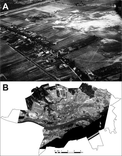
Figure 5. Destroyed and transformed dunes as percentage of areas of various use types: A – within contemporary city limits; B – in the urbanised area.
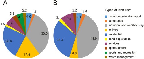
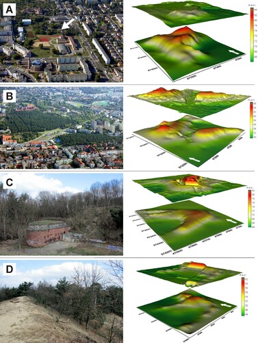
Figure 6. Examples of destroyed and transformed dunes and 3D models of the surface shape (lower model – morphology of primary dune; upper model – modern topography): A – the almost completely levelled Cossack Hill (an irregular dune), currently the area is occupied by a school, a gymnasium and a sports field, arrow indicates a preserved, built-on fragment of a dune; B – the afforested Hare Hills (irregular dunes), partly transformed by the construction of streets, a toboggan run and a petrol station; C – nose of parabolic dune destroyed by fort construction; D – the summit of a back-stop (part of the military shooting range) created by transforming a parabolic dune.