Figures & data
Figure 1. (a) Simplified active tectonic map of the Aegean Sea and the western Anatolia. The white box indicates the study area. The black arrows show the movement direction of the western Anatolia. GPS vectors are from CitationAktuğ et al. (2009). (b) Geological map of the Aydın Mountain and its near vicinity (compiled from CitationGürer et al., 2009; CitationKazanci et al., 2009; CitationKonak & Şenel, 2002). Faults are from CitationEmre et al. (2018). (c) The grabens in the study area. Yellow circles show earthquake epicenters between 1900 and 2019 recorded by the USGS. White boxes show river terraces in . Transparent white boxes indicate swath profiles in .
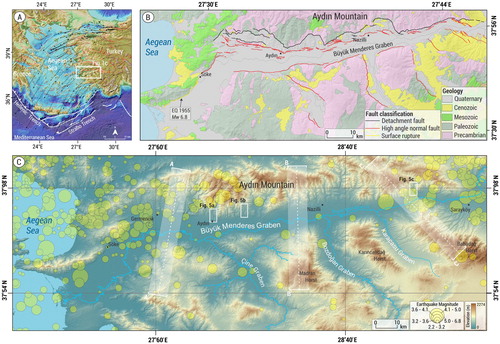
Figure 2. Red Relief Image Map (RRIM) production steps proposed by CitationChiba et al. (2008). The numbers indicate each processing step for the Esnek river terraces.
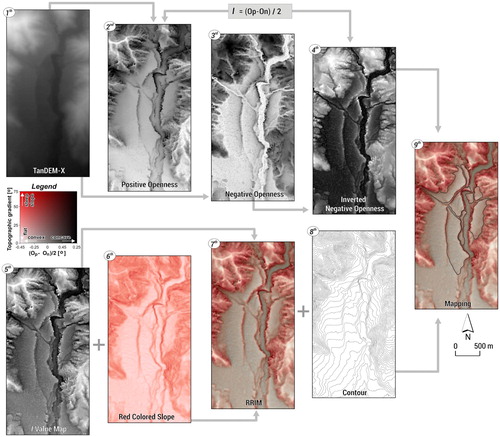
Figure 3. The examples of (a) the river terraces, (b) alluvial fan surface deformed by high-angle normal faults, (c) landslide, (d) relict alluvial fans, (e) modern alluvial fans and toe-cuts, (f) meander cut-offs and, (g) colluvial fans on the RRIM.
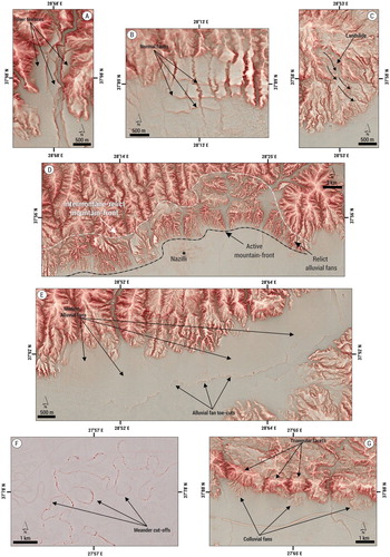
Figure 4. (a) The relict alluvial fans. (b) Modern alluvial fan in the eastern part of the BMG (Google Earth). (c) Colluvial fans and floodplain of the BMG. (d) Deep-seated landslide formed on Pliocene sediments (Google Earth). (e) Shallow landslide formed on relict alluvial fans. (f) Oblique drone picture of the cut-offs and the floodplain during a flood.
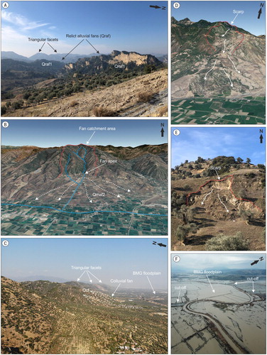
Figure 5. Oblique drone pictures of the river terraces. (a) Tabakhane, (b) Kabaklık, and (c) Esnek River. See c for locations.
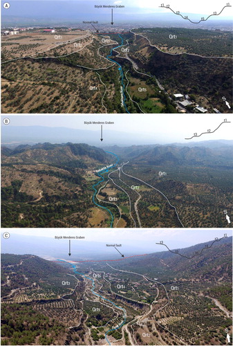
Figure 6. Deposits of the relict and modern alluvial fans. (a) The relict alluvial fan deposits named the Tmolosschutt. (b) The poorly sorted sediment structure of the relict alluvial fans. (c) The sediments of the relict alluvial fan back-tilted to the north. (d) A view of the more unconsolidated sediments toward the surface of the relict alluvial fans. (e,f) Sedimentary body of a modern alluvial fan with unconsolidated, angular, and poorly sorted clasts, in the eastern section of the BMG. The geological hammer is marked with a red arrow.
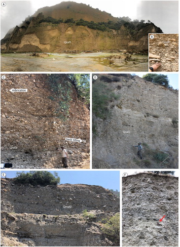
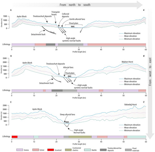
Figure 7. Swath profiles from west to the east. See c for the locality of the swath sections.