Figures & data
Figure 1. Sketch map of the Campana Plain coastal graben (location in the inset map) and volcanic areas of Campi Flegrei and Vesuvius, with the indication of the main Quaternary fault zones. The frame indicates the location of the satellite view of .
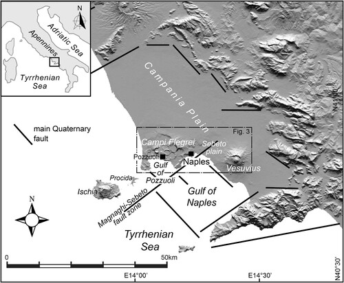
Figure 2. View, from the Posillipo coast, of the Vesuvius main cone, the rim of the Somma caldera and 1944 lava flows; the eastern part of the Naples urban area is visible on the left.
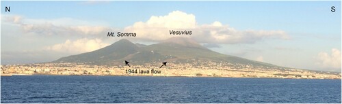
Figure 3. Satellite view (from GoogleEarthPro; location in ) of the Naples and Campi Flegrei area, with the indication of locations of the quarters of the Naples urban area and main towns of the Naples metropolitan area (yellow characters) and main toponyms (white characters). The white line delimitates Naples municipality.
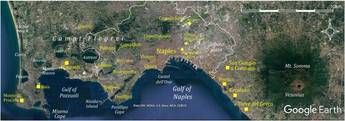
Figure 4. Views of the main geomorphological elements of the Campi Flegrei caldera inner area. A: View from the south (Posillipo hill) of the Campi Flegrei caldera rim and inner slopes (in the background) and the Bagnoli plain. B: View of the Gulf of Pozzuoli from the Miseno Cape, with indication of the Monte Nuovo and Gauro tuff cones and, in the background, the Monteruscello tuff ring; the dashed yellow line marks the surface of the La Starza marine terrace; in the foreground the northern rim (Pennata island) of the drowned crater, which hosted the Roman harbour of Miseno. C: Aerial view of Monte Nuovo volcano, formed in 1538 AD, Averno volcano and crater lake and Lucrino and Fusaro lagoons. D: View of the southern termination of the Gulf of Pozzuoli (right side), with the Nisida island and Miseno Cape; in the background the island of Ischia is visible. E: View from the west of the steep sea cliff eroded in the cone and crater of the 3.7 ka old Miseno volcano.
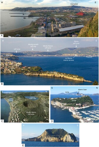
Figure 5. Evidence of post-Roman subsidence along the coast of Pozzuoli and Posilippo. A) Macellum columns with Lithofaga burrows up to 7 m a.s.l.; B) the Palazzo degli Spiriti Roman building with the first floor completely submerged.
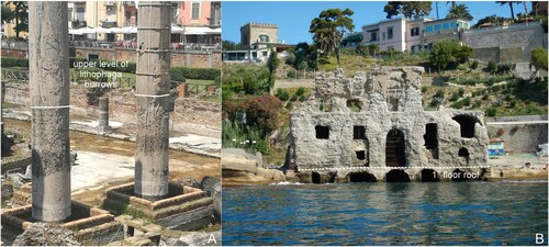
Figure 6. Rocky tufaceous cliffs with rockfalls along the Naples coast. A) Capo Miseno southern cliff; B) Trenataremi cliff; C) Coroglio cliff.
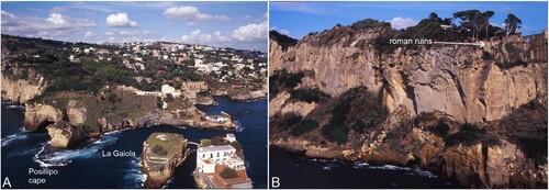
Figure 7. Views of the coast of Posillipo. A) La Gaiola; B) Posillipo Cape.