Figures & data
Figure 1. Geological setting of the middle Tocantins River, including the study area. (A) Main geological units of the area include high-grade metamorphic rocks of the Cajazeiras Complex, low-grade metamorphic rocks of the Couto Magalhães Formation, sedimentary deposits of the Itapecuru Group and Codó Formation (CitationVasquez & Rosa-Costa, 2008). (B) Location of the study area near the boundary between the Amazon and Cerrado biomes.
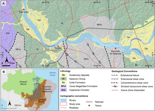
Figure 2. Geomorphological aspects of the middle Tocantins River: (A) Landsat-8 image true-color (September 2018); (B) MERIT digital elevation model; (C) Main landforms mapped that represents the relief/molding categorical levels.
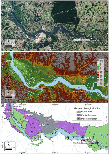
Figure 3. Hierarchical classification of mapping units of the middle Tocantins River.
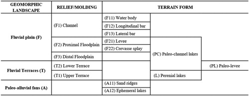
Figure 4. Bedrock rapids upstream middle Tocantins River. Digital Globe, GeoEye, CNES/Airbus DS. Change updated: August 8, 2019 to Accessed: August 8, 2019. Location in .
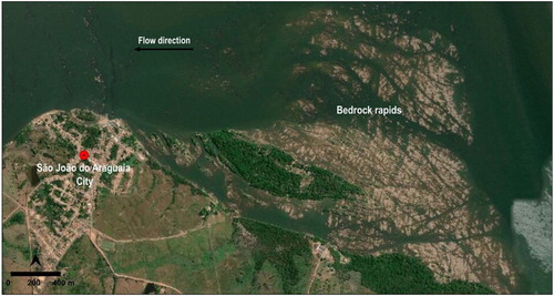
Figure 5. Geomorphic features within the channel unit. Location of photos and images in (C): (A) Longitudinal bar attached in vegetated bar; (B) Lateral bar with vegetated and non-vegetated. Digital Globe, GeoEye, CNES/Airbus DS Change updated: August 8, 2019 to Accessed: August 8, 2019. Location in .
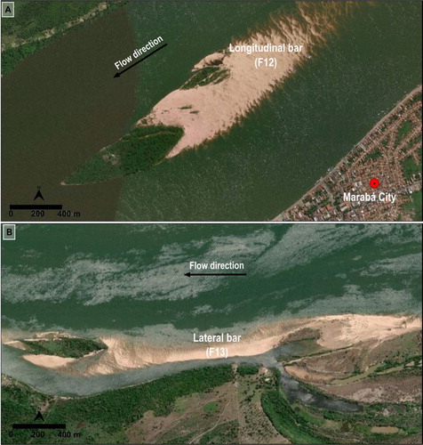
Figure 6. Geomorphic features of the floodplain. Location of photos and images in (C): (A) Levee within the proximal floodplain; (B) Levee located on the right bank of the main channel and covered by arboreal vegetation; (C) Lakes formed by paleo-channels within the floodplain; (D) Field view of paleo-channel. Figure (A) and (B) with images from Digital Globe, GeoEye, change updated: August 8, 2019 to Accessed: August 8, 2019.
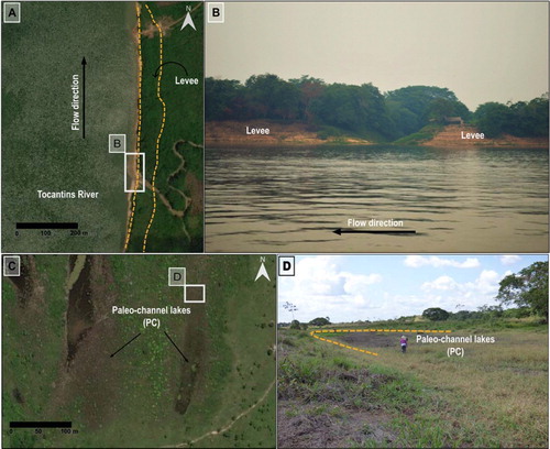
Figure 7. (#A) Crevasse splay in DEM image. (B) Crevasse splay highlighted by denser vegetation cover in Landsat 8 image true color (September 2018). Location in .
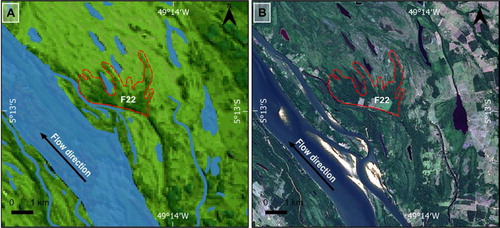
Figure 8. Geomorphic features of the terraces and paleo alluvial fan: (A and B) Regional relationship between fluvial terraces (T1 and T2), paleo alluvial fan and the fluvial plain, where an abrupt slope break marks the inner boundary of the proximal floodplain. Image A from Esri World Imagery, updated at Aug 8, 2019; Image B MERIT-DEM. Location in .
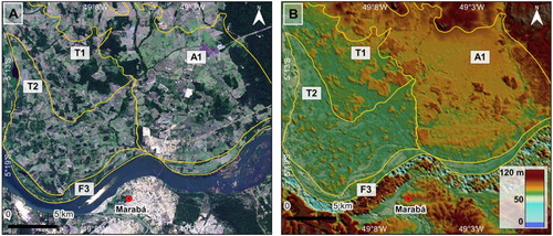
Figure 9. Geomorphic features of the paleo-alluvial fan unit. Longitudinal and transversal topographic profiles showing upward convex shape. Map showing the boundaries of the main paleo-alluvial fan, with indication of the longitudinal (line A-A’) and transverse (line B-B’ and line C-C’) profiles. Topographic data are from MERIT-DEM.
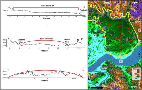
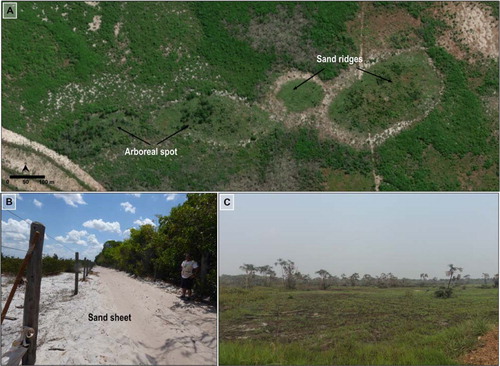
Figure 10. General aspects of the paleo-alluvial fans geomorphological unit. (A) Patches of diverse vegetation that comprises a mosaic of grasslands, shrubs, and arboreal forest spots; (B) Partial view of the sand sheet; (C) View of grasses and palm trees. Location in .